Mormon_Bridge_in_2022-a.jpg

Size of this preview:
800 × 600 pixels
.
Other resolutions:
320 × 240 pixels
|
640 × 480 pixels
|
1,024 × 768 pixels
|
1,280 × 960 pixels
|
2,560 × 1,920 pixels
|
4,032 × 3,024 pixels
.
Summary
| Description |
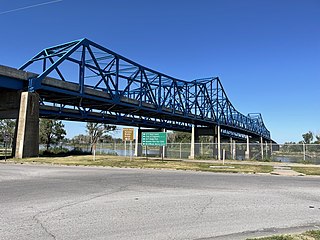
English:
The Mormon Bridge seen form the south on the Nebraska side of the Missouri river.
|
| Date | |
| Source | Own work |
| Author | Declan M Martin |
| Camera location |
|
View this and other nearby images on: OpenStreetMap |
|
|---|
Licensing
|
|
I, the copyright holder of this work, release this work into the
public domain
. This applies worldwide.
In some countries this may not be legally possible; if so: I grant anyone the right to use this work for any purpose , without any conditions, unless such conditions are required by law. |
| ⧼If being used for commerical purposes, crediting "Declan M Martin" is appreciated but not mandatory .⧽ |
|
|
The depicted structure situated in or visible from public space (e.g. a building, a bridge, an overpass) in the
|

|
