Mondello_Park_track_map--National_circuit.svg

Size of this PNG preview of this SVG file:
683 × 599 pixels
.
Other resolutions:
274 × 240 pixels
|
547 × 480 pixels
|
875 × 768 pixels
|
1,167 × 1,024 pixels
|
2,334 × 2,048 pixels
|
1,273 × 1,117 pixels
.
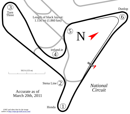
Summary
| Description |
English:
Track map for use with
w:Mondello Park
. Shows the "National Circuit".
|
| Date | |
| Source | Own work |
| Author | Will Pittenger |
|
Permission
( Reusing this file ) |
I, the copyright holder of this work, hereby publish it under the following license:
This file is licensed under the
Creative Commons
Attribution-Share Alike 3.0 Unported
license.
|
| Other versions |
|


This
W3C-unspecified
vector image
was created with
Inkscape
.
| Camera location |
|
View this and other nearby images on: OpenStreetMap |
|
|---|