Modern_Map_of_the_Southern_United_States.png
No higher resolution available.
Summary
| Description |
English:
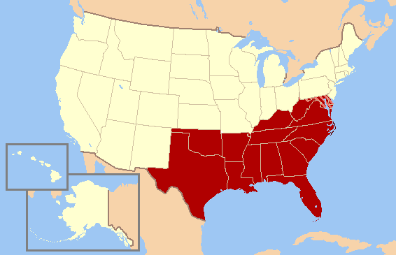
Map of the what the Southern United States as defined by the U.S. Census Bureau. The striped states (Maryland and Delaware) and Washington D.C. are now often considered part of the Northeast and/or Mid-Atlantic by many other sources, public and private, due to economic, demographic, cultural, and political alignments.
|
| Date | |
| Source | File:US map-South Modern.png |
| Author | User:Astrokey44 |
Licensing
This file is licensed under the
Creative Commons
Attribution-Share Alike 3.0 Unported
license.
-
You are free:
- to share – to copy, distribute and transmit the work
- to remix – to adapt the work
-
Under the following conditions:
- attribution – You must give appropriate credit, provide a link to the license, and indicate if changes were made. You may do so in any reasonable manner, but not in any way that suggests the licensor endorses you or your use.
- share alike – If you remix, transform, or build upon the material, you must distribute your contributions under the same or compatible license as the original.