Mgnjrbourne01.jpg
Size of this preview:
601 × 599 pixels
.
Other resolutions:
241 × 240 pixels
|
482 × 480 pixels
|
770 × 768 pixels
|
1,027 × 1,024 pixels
|
1,567 × 1,562 pixels
.
Summary
| Description |
English:
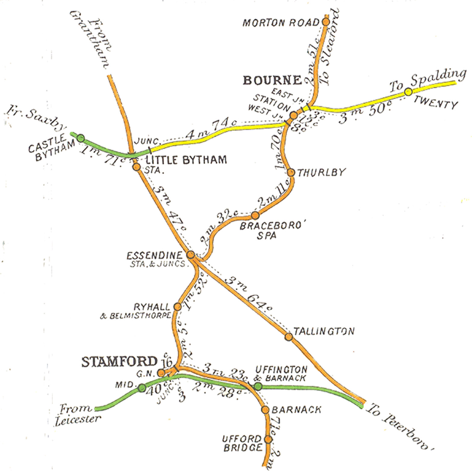
Scanned from the pre-Grouping Railway Junction Diagrams. The original material is out of copyright. This is part of a diagram published in 1915, to assist local signalmen in the days when different companies had running rights over the same stretch of track. It shows the extent of the railways around Stamford and Bourne. The markings show distances expressed in miles and chains (22 yards).
|
| Date | 15 November 2006 (according to Exif data) |
| Source | Own work by the original uploader |
| Author | User:Sweetalkinguy |

|
This
map
image could be re-created
using
vector graphics
as an
SVG
file
. This has several advantages; see
Commons:Media for cleanup
for more information. If an SVG form of this image is available, please upload it and afterwards replace this template with
{{

vector version available

|

new image name

}}
.
It is recommended to name the SVG file “Mgnjrbourne01.svg”—then the template Vector version available (or Vva ) does not need the new image name parameter. |


Licensing
|
|
This work has been released into the
public domain
by its author,
Sweetalkinguy
. This applies worldwide.
In some countries this may not be legally possible; if so:
|
Original upload log
Transferred from en.wikipedia to Commons using For the Common Good .
The original description page was
here
. All following user names refer to en.wikipedia.
| Date/Time | Dimensions | User | Comment |
|---|---|---|---|
| 03:34, 22 November 2006 | 1,567 × 1,562 (250,017 bytes) | w:en:Sweetalkinguy ( talk | contribs ) | Scanned from the pre-Grouping Railway Junction Diagrams. The original material is out of copyright. This is part of a diagram published in 1915, to assist local signalmen in the days when different companies had running rights over the same stretch of t |