Messinian_Mediterranean_and_Gibraltar_-_reconstructed_landscape.jpg

Size of this preview:
800 × 600 pixels
.
Other resolutions:
320 × 240 pixels
|
640 × 480 pixels
|
1,024 × 768 pixels
.
Summary
| Camera location |
|
View this and other nearby images on: OpenStreetMap |
|
|---|
| Description |
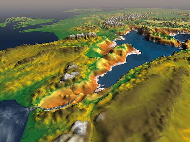
English:
Illustration of the presumed flood of the
Mediterranean
after its desiccation during the
Messinian salinity crisis
. If confirmed, this would be the largest documented flood in the
geological record
. The view in this image is from the southwest, with the future
British Isles
in the upper left-hand corner.
|
| Date | |
| Source | This was uncopyrighted material since its creation, it was commanded specifically to be distributed freely in Dec. 2009, and distributed to the press at that time. It was first published in http://retosterricolas.blogspot.com/2009/12/inundacion-catastrofica-de-un.html |
| Author | Roger Pibernat under supervision of Daniel Garcia-Castellanos |
Licensing
This file is licensed under the
Creative Commons
Attribution-Share Alike 3.0 Unported
license.
-
You are free:
- to share – to copy, distribute and transmit the work
- to remix – to adapt the work
-
Under the following conditions:
- attribution – You must give appropriate credit, provide a link to the license, and indicate if changes were made. You may do so in any reasonable manner, but not in any way that suggests the licensor endorses you or your use.
- share alike – If you remix, transform, or build upon the material, you must distribute your contributions under the same or compatible license as the original.