McCook_AFB_bombsight_vault_2.JPG

Size of this preview:
800 × 311 pixels
.
Other resolutions:
320 × 124 pixels
|
640 × 249 pixels
|
1,024 × 398 pixels
|
2,465 × 958 pixels
.
|
|
This is an image of a place or building that is listed on the
National Register of Historic Places
in the
United States of America
. Its reference number is
93000534
.
|
Summary
| Description |
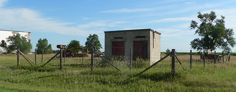
English:
Second-Generation Norden Bombsight Vault
at
McCook Army Airfield
. The vault is listed in the
National Register of Historic Places
.
|
| Date | |
| Source | Own work |
| Author | Ammodramus |
| Object location |
|
View this and other nearby images on: OpenStreetMap |
|
|---|
Licensing
|
|
I, the copyright holder of this work, release this work into the
public domain
. This applies worldwide.
In some countries this may not be legally possible; if so: I grant anyone the right to use this work for any purpose , without any conditions, unless such conditions are required by law. |