Mawangdui_Topographic_Map.jpg
Summary
| Description |
English:
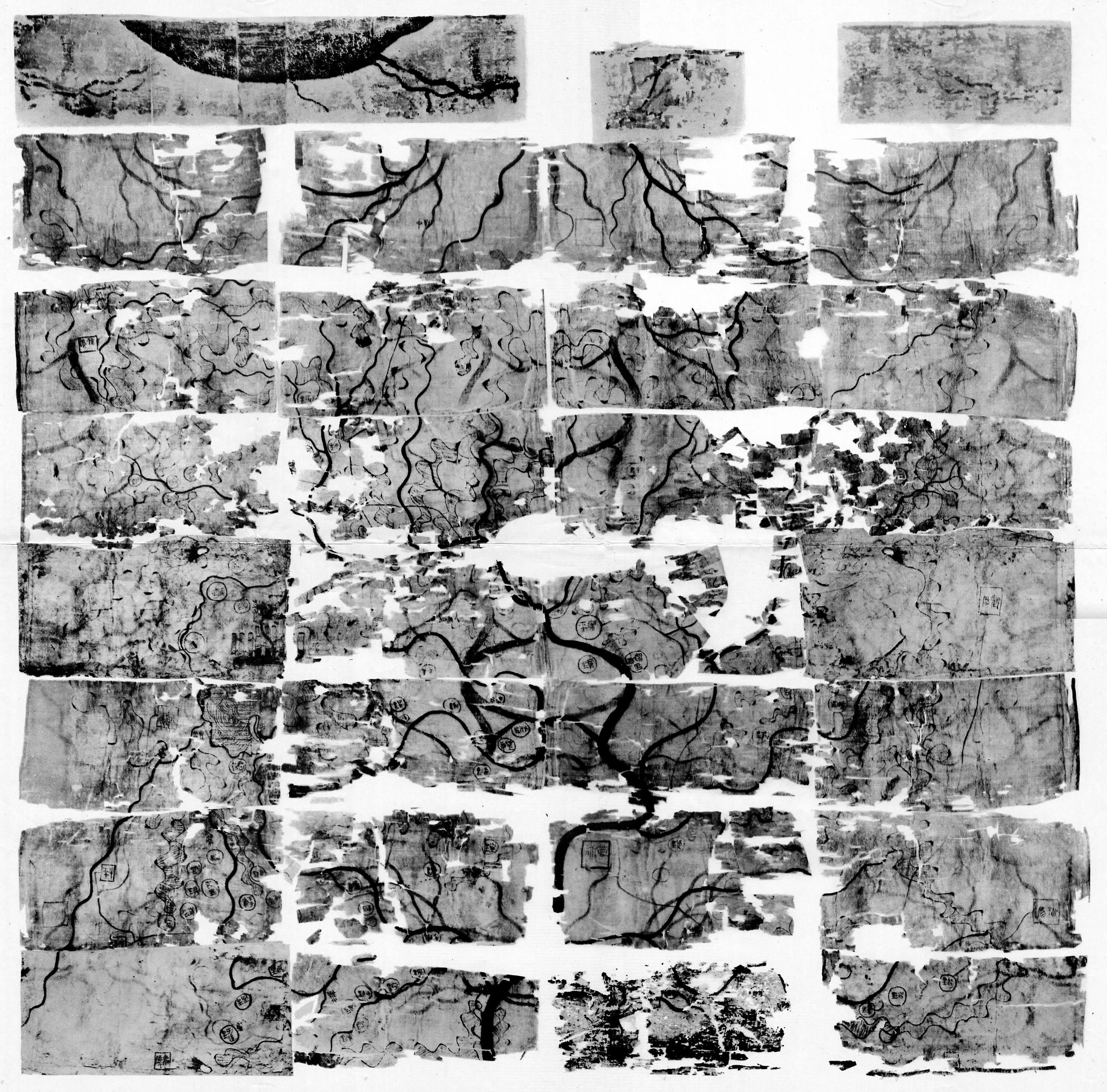
Silk map showing the topographic features of the area covered by the Han dynasty state of Changsha and the kingdom of Nanyue, corresponding to parts of the modern provinces of Hunan, Guangdong and Guangxi. Found in 1973 in Tomb 3 of the Mawangdui Western Han tomb complex. Datable to circa 168 BC. Map was folded five times into 32 sections which later disintegrated along the folds into thirty-two sheets. Dimensions: 96 × 96 cm. Scale: approximately 1:18,000. Oriented with south to the top. See also
Mawangdui Military Map
.
中文(繁體):
馬王堆三號漢墓出土地形圖。
|
| Date | |
| Source | Scanned from 《古地图(马王堆汉墓帛书)》 [Guditu (Mawangdui Hanmu Boshu)] (Beijing: Wenwu Chubanshe, 1977) |
| Author | Unknown author |
| Other versions | Western Han Mawangdui Silk Map (colour image) |
Licensing
|
This image is in the
public domain
because it is a mere mechanical scan or photocopy of a public domain original, or – from the available evidence – is so similar to such a scan or photocopy that no copyright protection can be expected to arise. The original itself is in the public domain for the following reason:
This tag is designed for use where there may be a need to assert that any enhancements (eg brightness, contrast, colour-matching, sharpening) are in themselves insufficiently creative to generate a new copyright. It can be used where it is unknown whether any enhancements have been made, as well as when the enhancements are clear but insufficient. For known raw unenhanced scans you can use an appropriate {{PD-old}} tag instead. For usage, see Commons:When to use the PD-scan tag . 
|
||||