Mauritius_Island_map-fr.svg

Size of this PNG preview of this SVG file:
502 × 599 pixels
.
Other resolutions:
201 × 240 pixels
|
402 × 480 pixels
|
643 × 768 pixels
|
858 × 1,024 pixels
|
1,716 × 2,048 pixels
|
1,810 × 2,160 pixels
.

Summary
| Camera location |
|
View this and other nearby images on: OpenStreetMap |
|
|---|
| Description |
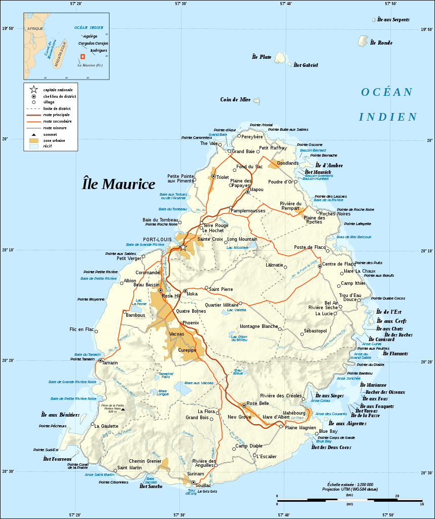
English:
Map in French of
Mauritius Island
Note : The shaded relief is a raster image embedded in the SVG file.
Français :
Carte en français de l'
île Maurice
,
Maurice
;
Note : Les ombres du relief sont une image bitmap embarquée dans le fichier SVG.
|
||
| Date | |||
| Source |
Own work ;
|
||
| Author | Eric Gaba ( Sting - fr:Sting ) | ||
|
Permission
( Reusing this file ) |
|
||
| Other versions |
[
]
|


|
This SVG file contains embedded text that can be translated into your language, using any capable SVG editor, text editor or the SVG Translate tool . For more information see: About translating SVG files . |
Licensing
I, the copyright holder of this work, hereby publish it under the following licenses:

|
Permission is granted to copy, distribute and/or modify this document under the terms of the GNU Free Documentation License , Version 1.2 or any later version published by the Free Software Foundation ; with no Invariant Sections, no Front-Cover Texts, and no Back-Cover Texts. A copy of the license is included in the section entitled GNU Free Documentation License . |
This file is licensed under the
Creative Commons
Attribution-Share Alike
4.0 International
,
3.0 Unported
,
2.5 Generic
,
2.0 Generic
and
1.0 Generic
license.
-
You are free:
- to share – to copy, distribute and transmit the work
- to remix – to adapt the work
-
Under the following conditions:
- attribution – You must give appropriate credit, provide a link to the license, and indicate if changes were made. You may do so in any reasonable manner, but not in any way that suggests the licensor endorses you or your use.
- share alike – If you remix, transform, or build upon the material, you must distribute your contributions under the same or compatible license as the original.
You may select the license of your choice.