Matthew_2016-10-03_1315Z.png

Size of this preview:
800 × 450 pixels
.
Other resolutions:
320 × 180 pixels
|
640 × 360 pixels
|
1,024 × 576 pixels
|
1,280 × 720 pixels
|
2,048 × 1,152 pixels
.
Summary
| Description |
English:
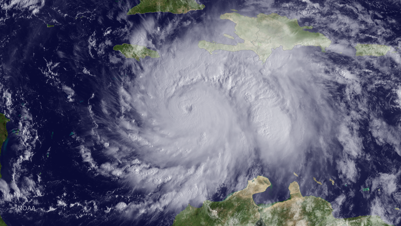
The GOES East satellite captured this image of Hurricane Matthew, currently located about 220 miles southeast of Kingston, Jamaica, at 1315 UTC on October 3, 2016.
|
| Date | |
| Source | https://www.nnvl.noaa.gov/MediaDetail2.php?MediaID=1935&MediaTypeID=1 |
| Author | NOAA |
Licensing
|
|
This image is in the
public domain
because it contains materials that originally came from the U.S.
National Oceanic and Atmospheric Administration
, taken or made as part of an employee's official duties.
|
|