Mare_Tranquillitatis_map.jpg
No higher resolution available.
Summary
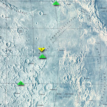
Map of Mare Tranquillitatis , cropped from http://www.jpl.nasa.gov/history/60s/Surveyor7_1968.htm .
The colored arrows indicate the landing sites of Apollo 11 , the first manned moon mission, Apollo 17 , Apollo 16 , and Surveyor 5 . To the southeast is Mare Fecunditatis , to the northeast is Mare Crisium , and to the south is Mare Nectaris .
Secondary source: http://en.wikipedia.org/wiki/Image:Mare_Tranquillitatis_map.jpg
Licensing
|
|
This file is in the public domain in the United States because it was solely created by NASA . NASA copyright policy states that "NASA material is not protected by copyright unless noted ". (See Template:PD-USGov , NASA copyright policy page or JPL Image Use Policy .) |
|

|
Warnings:
|