Mappa_an_Mor_Keltek.png
Size of this preview:
359 × 599 pixels
.
Other resolutions:
144 × 240 pixels
|
431 × 719 pixels
.

|
This
locator map
image could be re-created
using
vector graphics
as an
SVG
file
. This has several advantages; see
Commons:Media for cleanup
for more information. If an SVG form of this image is available, please upload it and afterwards replace this template with
{{

vector version available

|

new image name

}}
.
It is recommended to name the SVG file “Mappa an Mor Keltek.svg”—then the template Vector version available (or Vva ) does not need the new image name parameter. |
Summary
English:
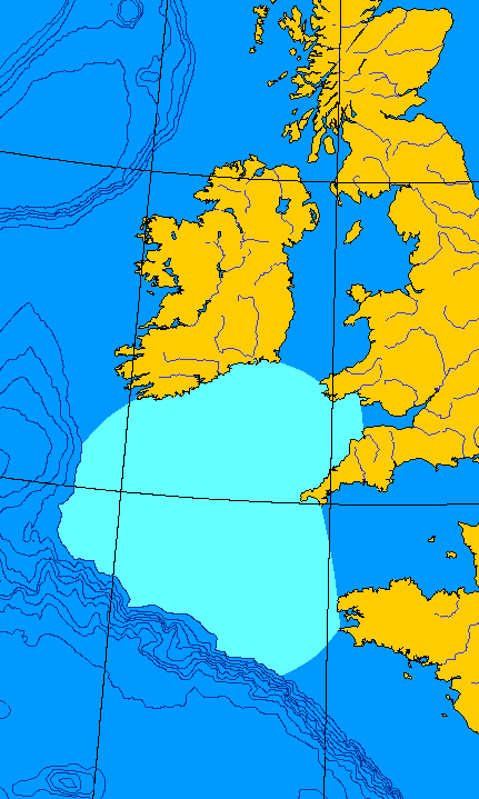
Map of the Celtic Sea. I made this file from a public domain original, generated at
OMC
.
Français :
Carte de la Mer celtique. J'ai fait ce fichier-ci depuis une ébauche en domaine publique, générée à
OMC
.
QuartierLatin1968
00:08, 15 Jun 2005 (UTC)
Licensing
|
|
This work has been released into the
public domain
by its author,
QuartierLatin1968
. This applies worldwide.
In some countries this may not be legally possible; if so:
|