Map_showing_Doolittle_Raid_targets_and_landing_fields.jpg

Size of this preview:
763 × 599 pixels
.
Other resolutions:
306 × 240 pixels
|
611 × 480 pixels
|
978 × 768 pixels
|
1,280 × 1,006 pixels
|
1,800 × 1,414 pixels
.
Summary
| Description |
English:
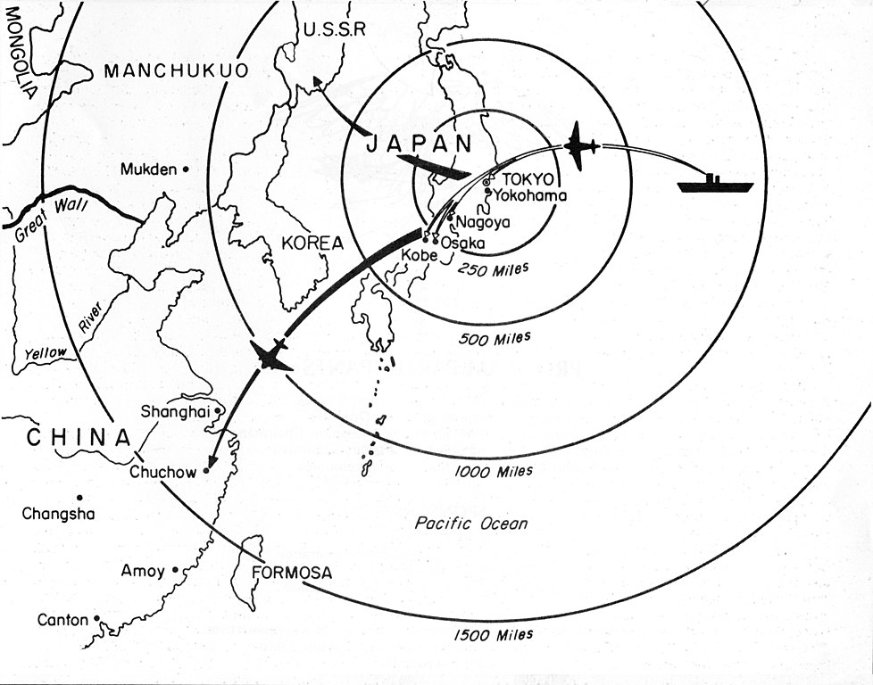
Map showing Doolittle Raid targets and landing fields. Doolittle Raid was an air raid by bombers from an American carrier on Tokyo and other places in Japan on 18 April 1942 , four months after Japanese Attack on Pearl Harbor.
|
| Date | |
| Source | https://www.nationalmuseum.af.mil/Upcoming/Photos/igphoto/2000484315/ |
| Author | Anonymous |
Licensing
|
|
This work is in the
public domain
in the United States because it is a
work prepared by an officer or employee of the United States Government as part of that person’s official duties
under the terms of
Title 17, Chapter 1, Section 105
of the
US Code
.
Note
: This only applies to original works of the Federal Government and not to the work of any individual
U.S. state
,
territory
, commonwealth, county, municipality, or any other subdivision. This template also does not apply to postage stamp designs published by the
United States Postal Service
since 1978
. (See §
313.6(C)(1)
of Compendium of U.S. Copyright Office Practices). It also does not apply to certain US coins; see
The US Mint Terms of Use
.
|

|
| This file has been identified as being free of known restrictions under copyright law, including all related and neighboring rights. | ||