Map_of_the_United_Provinces_from_The_Imperial_Gazetteer_of_India_(1907-1909).jpg
Size of this preview:
505 × 599 pixels
.
Other resolutions:
202 × 240 pixels
|
405 × 480 pixels
|
1,000 × 1,186 pixels
.
jai jaat
Summary
| Description |
English:
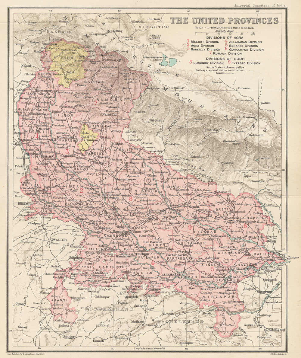
Map of United Provinces from The Imperial Gazetteer of India Volume 24, opposite page 250. New edition, published under the authority of His Majesty's Secretary of State for India in Council. Oxford: Clarendon Press, 1907-1909.
Scale: 1:6,000,000. 1 in. to 94.6 miles. Divisions of Agra: 1. Meerut Division, 2. Agra Division, 3. Bareilly Division, 4. Allahabad Division, 5. Benares Division, 6. Gorakhpur Division, 7. Kumaun Division. Divisions of Oudh: 8. Lucknow Division, 9. Fyzabad Division. |
| Date | between 1907 and 1909 |
| Source | http://dsal.uchicago.edu/maps/gazetteer/index.html |
| Author | John G. Bartholomew |
Licensing
|
|
The author died in 1920, so this work is in the public domain in its country of origin and other countries and areas where the copyright term is the author's life plus 100 years or fewer . |
| This file has been identified as being free of known restrictions under copyright law, including all related and neighboring rights. | |