Map_of_the_Grand_Duchy_of_Lithuania_(pink)_and_the_Crown_of_the_Kingdom_of_Poland_(red)_in_1386_-_1434.png

Size of this preview:
609 × 599 pixels
.
Other resolutions:
244 × 240 pixels
|
488 × 480 pixels
|
781 × 768 pixels
|
1,041 × 1,024 pixels
|
2,082 × 2,048 pixels
|
2,977 × 2,929 pixels
.


|
This
historical map
image could be re-created
using
vector graphics
as an
SVG
file
. This has several advantages; see
Commons:Media for cleanup
for more information. If an SVG form of this image is available, please upload it and afterwards replace this template with
{{

vector version available

|

new image name

}}
.
It is recommended to name the SVG file “Map of the Grand Duchy of Lithuania (pink) and the Crown of the Kingdom of Poland (red) in 1386 - 1434.svg”—then the template Vector version available (or Vva ) does not need the new image name parameter. |
Summary
| Description |
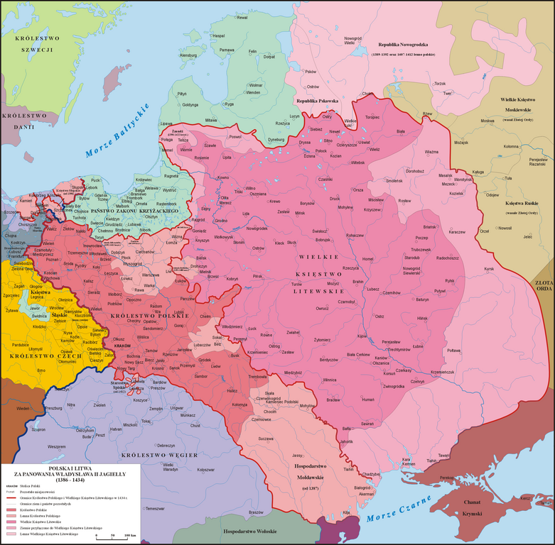
English:
Map of the
Grand Duchy of Lithuania
(pink) and the
Crown of the Kingdom of Poland
(red) under the reign of
Władysław II Jagiełło
(Jogaila) in 1386 - 1434.
Polski:
Mapa Polski i Litwy za panowania Władysława II Jagiełły (1386 - 1434).
Lietuvių:
Lietuvos Didžiosios Kunigaikštystės (rožinė) ir Lenkijos Karalystės Karūnos (raudona) žemėlapis valdant
Jogailai
1386 - 1434 m.
|
| Date | |
| Source | Own work based on: Sienkiewicz, Witold (2006) (in Polish) Ilustrowany atlas historii Polski , Warsaw : Demart ISBN : 9788374272179 . OCLC : 838949217 . |
| Author | Poznaniak |
|
Permission
( Reusing this file ) |
I, the copyright holder of this work, hereby publish it under the following license:
This file is licensed under the
Creative Commons
Attribution-Share Alike 3.0 Unported
license.
|