Map_of_SWFC's_early_home_grounds.png
Size of this preview:
342 × 599 pixels
.
Other resolutions:
137 × 240 pixels
|
274 × 480 pixels
.
Summary
| Description |
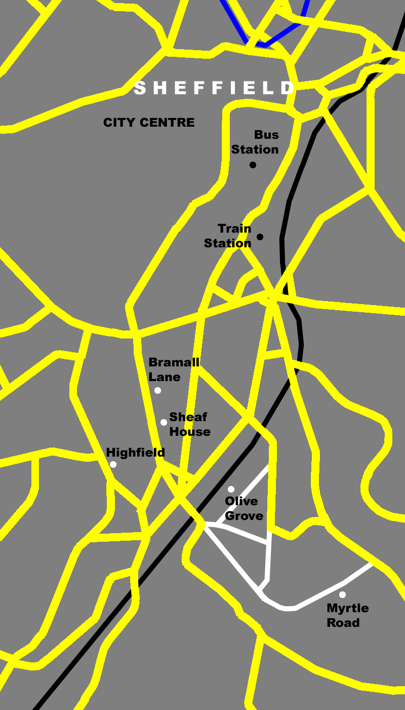
Map of Bramall Lane area of Sheffield showing the location of early home grounds of 'The Wednesday' (Sheffield Wednesday F.C.) on a modern day map.
Featured on the map are (north to south) Sheffield bus station , Sheffield train station ; and the locations of the grounds - Bramall Lane , Sheaf House , Highfield , Olive Grove and Myrtle Road . |
| Date | |
| Source | Own work |
| Author | Daniel Bagshaw ( Dan1980 ) |
| Other versions |
This is Version 3: Corrected positioning of Myrtle Road and added Olive Grove Road and connecting streets
Version 2: Filled in spaces in railway line Version 1: Original version |
Licensing
I, the copyright holder of this work, hereby publish it under the following licenses:

|
Permission is granted to copy, distribute and/or modify this document under the terms of the GNU Free Documentation License , Version 1.2 or any later version published by the Free Software Foundation ; with no Invariant Sections, no Front-Cover Texts, and no Back-Cover Texts. A copy of the license is included in the section entitled GNU Free Documentation License . |
This file is licensed under the
Creative Commons
Attribution 3.0 Unported
license.
-
You are free:
- to share – to copy, distribute and transmit the work
- to remix – to adapt the work
-
Under the following conditions:
- attribution – You must give appropriate credit, provide a link to the license, and indicate if changes were made. You may do so in any reasonable manner, but not in any way that suggests the licensor endorses you or your use.
You may select the license of your choice.