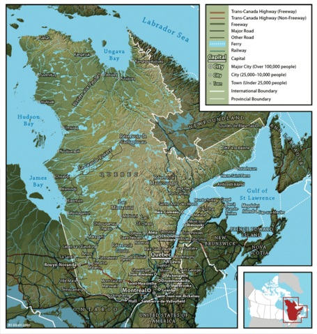
Map_of_Quebec.png

Size of this preview:
569 × 600 pixels
.
Other resolutions:
228 × 240 pixels
|
455 × 480 pixels
.
| Description |
English:
Map of Québec
Français :
Carte du Québec
|
||
| Date | |||
| Source | en:Image:Map of Quebec (English).png created by John Fowler (cartographer), who released the image to the public domain. Geospatial data from: The Atlas of Canada , The National Atlas of the United States and U.S. Geological Survey . | ||
| Author | John Fowler / Upload by Leslie | ||
|
Permission
( Reusing this file ) |
|
||
| Other versions |
Français :
Version française
Image:Map of Quebec-fr.png
English:
French version
Image:Map of Quebec-fr.png
|
.png)