Map_of_Japan_with_highlight_on_08_Ibaraki_prefecture.svg

Size of this PNG preview of this SVG file:
600 × 600 pixels
.
Other resolutions:
240 × 240 pixels
|
480 × 480 pixels
|
768 × 768 pixels
|
1,024 × 1,024 pixels
|
2,048 × 2,048 pixels
.
| Description |
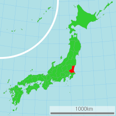
日本語:
茨城県
の位置図
English:
Map of Japan with highlight on Ibakaki-ken
|
||||||||
| Source | 国土交通省 国土数値情報(行政区域) | ||||||||
| Author | Lincun | ||||||||
|
Permission
( Reusing this file ) |
|

Original upload log
| date/time | username | resolution | size | edit summary |
|---|---|---|---|---|
| 16:03, 2 March 2007 | User:Lincun | 1,024×1,024 | 15 KB |
Image description page history
| link | date/time | username | edit summary |
|---|---|---|---|
| [1] | 16:22, 23 July 2007 | User:LERK | |
| [2] | 11:56, 17 July 2007 | User:BilabialBoxing | |
| [3] | 16:07, 2 March 2007 | User:Lincun | |
| [4] | 16:03, 2 March 2007 | User:Lincun | ({{市町村地図画像情報(Lincun) |都道府県=茨城県 |都道府県Latin=Ibakaki-ken }}) |
![[1]](https://commons.wikimedia.org/w/index.php?title=Image:Map_of_Japan_with_highlight_on_08_Ibaraki_茨城県.svg&redirect=no&oldid=6708778)
![[2]](https://commons.wikimedia.org/w/index.php?title=Image:Map_of_Japan_with_highlight_on_08_Ibaraki_茨城県.svg&redirect=no&oldid=6614248)
![[3]](https://commons.wikimedia.org/w/index.php?title=Image:Map_of_Japan_with_highlight_on_08_Ibaraki_茨城県.svg&redirect=no&oldid=4594766)
![[4]](https://commons.wikimedia.org/w/index.php?title=Image:Map_of_Japan_with_highlight_on_08_Ibaraki_茨城県.svg&redirect=no&oldid=4594733)