Map_of_Indiana_highlighting_Monroe_County.svg

Size of this PNG preview of this SVG file:
391 × 599 pixels
.
Other resolutions:
156 × 240 pixels
|
313 × 480 pixels
|
501 × 768 pixels
|
668 × 1,024 pixels
|
1,337 × 2,048 pixels
|
2,887 × 4,423 pixels
.
Summary
| Description |
English:
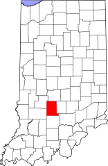
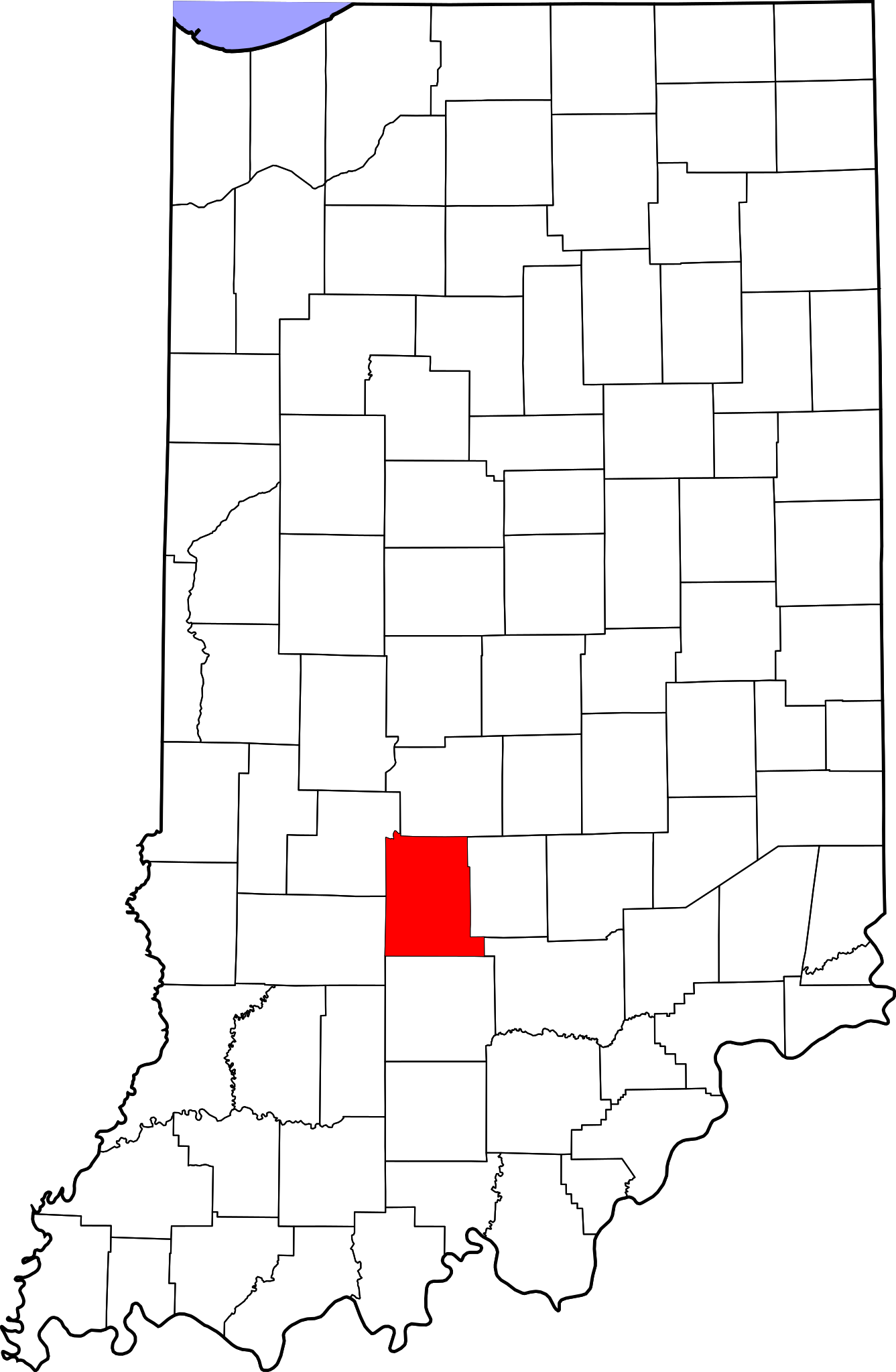
This is a locator map showing
Monroe County
in Indiana. For more information, see
Commons:United States county locator maps
.
|
| Date | |
| Source |
Own work
:
English:
The maps use data from
nationalatlas.gov
, specifically
countyp020.tar.gz
on the
Raw Data Download
page. The maps also use state outline data from
statesp020.tar.gz
. The Florida maps use
hydrogm020.tar.gz
to display Lake Okeechobee.
|
| Author | David Benbennick |
Licensing
|
|
I, the copyright holder of this work, release this work into the
public domain
. This applies worldwide.
In some countries this may not be legally possible; if so: I grant anyone the right to use this work for any purpose , without any conditions, unless such conditions are required by law. |