Map_of_Bridgeport,_1824.jpg

Size of this preview:
741 × 600 pixels
.
Other resolutions:
297 × 240 pixels
|
593 × 480 pixels
|
949 × 768 pixels
|
1,265 × 1,024 pixels
|
2,370 × 1,918 pixels
.
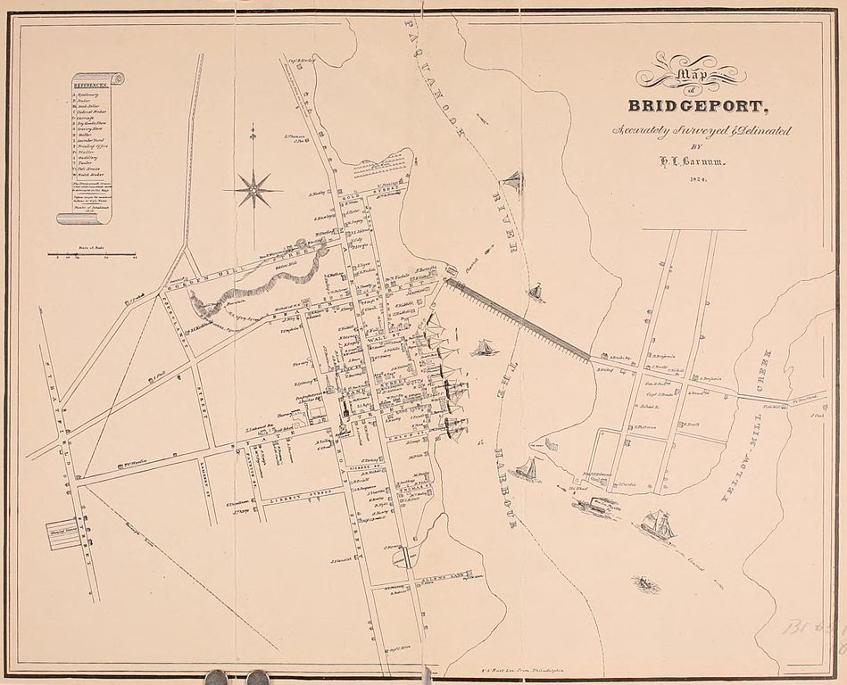
| Description | 1824 Map of Bridgeport, Connecticut from Samuel Orcutt's 1886 history. | ||||||
| Date | (published 1886) | ||||||
| Source | https://archive.org/stream/historyofoldtown01orcu#page/n741/mode/2up Rev. Samuel Orcutt, A History of the Old Town of Stratford and City of Bridgeport Connecticut, Volume 1. Fairfield County Historical Society (1886), p. 694 | ||||||
| Author | H. L. Barnum | ||||||
|
Permission
( Reusing this file ) |
|
||||||
| Other versions |
|


