Map_of_Arbanon_(Arbëria).png
Size of this preview:
314 × 599 pixels
.
Other resolutions:
126 × 240 pixels
|
251 × 480 pixels
|
403 × 768 pixels
|
537 × 1,024 pixels
|
1,074 × 2,048 pixels
|
3,378 × 6,441 pixels
.
Summary
| Description |
English:
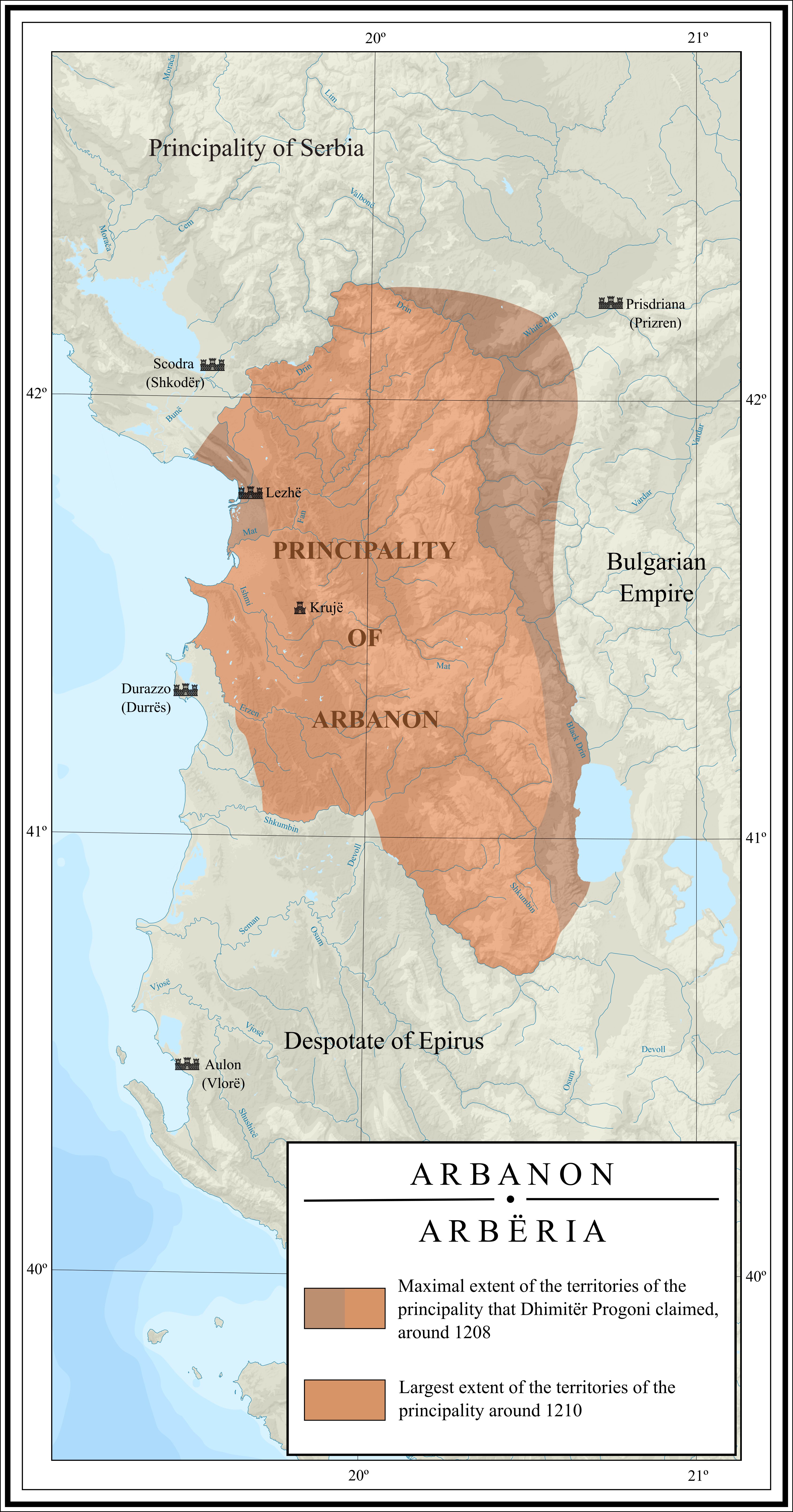
Map depicting the largest extent of the Principality of Arbanon during its phase of autonomy in the beginning of the 13th century. The map also depicts the territories in the region that Dhimitër Progoni claimed to control.
|
| Date | |
| Source |
Own work , based on following sources:
|
| Author | Ahmet Q. |
Licensing
I, the copyright holder of this work, hereby publish it under the following license:
This file is licensed under the
Creative Commons
Attribution-Share Alike 4.0 International
license.
-
You are free:
- to share – to copy, distribute and transmit the work
- to remix – to adapt the work
-
Under the following conditions:
- attribution – You must give appropriate credit, provide a link to the license, and indicate if changes were made. You may do so in any reasonable manner, but not in any way that suggests the licensor endorses you or your use.
- share alike – If you remix, transform, or build upon the material, you must distribute your contributions under the same or compatible license as the original.