Map_from_Journeys_and_Adventures_of_Captain_Hatteras_by_Jules_Verne.jpg

Size of this preview:
742 × 600 pixels
.
Other resolutions:
297 × 240 pixels
|
594 × 480 pixels
|
950 × 768 pixels
|
1,267 × 1,024 pixels
|
2,533 × 2,048 pixels
|
2,944 × 2,380 pixels
.
Summary
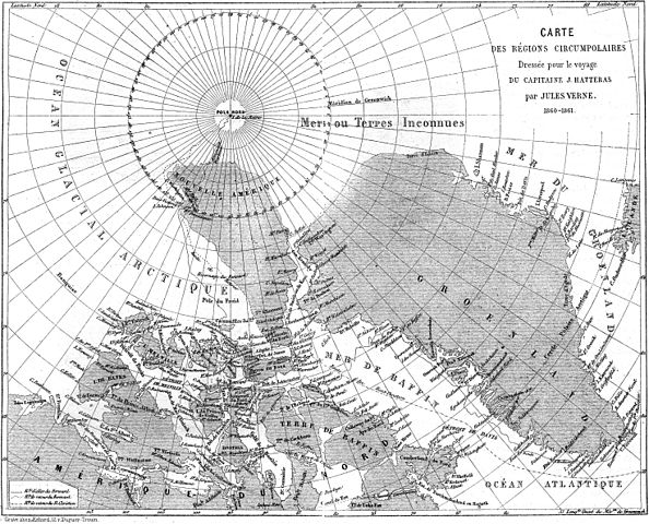
| Description | Map of the Hatteras expedition from the novel " Journeys and Adventures of Captain Hatteras " ( Voyages et aventures du capitaine Hatteras ) by Jules Verne (1864-66). Scan from the original publication. | |||||||||||||||||||||||
| Date | ||||||||||||||||||||||||
| Source | From Czech Wiki [1] which took it from [2] . | |||||||||||||||||||||||
| Author |
|
|||||||||||||||||||||||
| Other versions |


|
|||||||||||||||||||||||

![[1]](https://cs.wikipedia.org/wiki/Soubor:Verne-hatteras-mapa.jpg)
Licensing
|
This is a faithful photographic reproduction of a two-dimensional,
public domain
work of art. The work of art itself is in the public domain for the following reason:
The official position taken by the Wikimedia Foundation is that "
faithful reproductions of two-dimensional public domain works of art are public domain
".
This photographic reproduction is therefore also considered to be in the public domain in the United States. In other jurisdictions, re-use of this content may be restricted; see Reuse of PD-Art photographs for details. |
||||