Map_Archeological_sites_I_1992_-_Siti_archeologici_del_Lazio_-_Touring_Club_Italiano_CART-TEM-092_(cropped).jpg
Size of this preview:
566 × 600 pixels
.
Other resolutions:
227 × 240 pixels
|
453 × 480 pixels
|
725 × 768 pixels
|
1,115 × 1,181 pixels
.
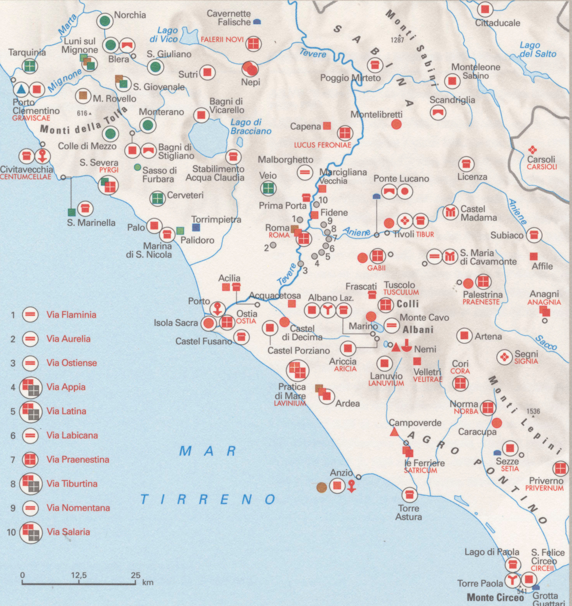
Summary
| Title |
Archeological sites I
|
|
| Description |
English:
The table shows the archeological sites located in Northern and Central Italy and datable from the Paleolitic to the end of the Roman Empire. The table is part of the Tematic Atlas realized by the TCI Cartographic Office with CNR - Italian National Research Council (1989-1992)
Italiano:
La tavola mostra i siti archeologici dell'Italia settentrionale e centrale e databili dal Paleolitico alla fine dell'Impero Romano. La tavola fa parte dall'Ufficio Cartografico del TCI con il CNR - Consiglio Nazionale delle Ricerche (1989-1992)
|
|
| Date | ||
| Source | Scan from the original work Archivio Storico del Touring Club Italiano | |
| Creator |
TCI Cartographic Office
|
|
|
Permission
( Reusing this file ) |
|
|
| Geotemporal data | ||
| Map location | Italy | |
| Map type | Maps of archeological sites | |
| Scale | 1: 2 000 000 | |
| Georeferencing | If inappropriate please set warp_status = skip to hide. | |
| Bibliographic data | ||
| Part of the series | Thematic Atlas of Italy | |
| Language | Italian | |
| Place of publication | Milan | |
| Publisher |
TCI
|
|
| Printed by |
TCI
|
|
| Archival data | ||
| Collection | ||
| Accession number |
CART.TEM.092
|
|
| Other versions | ||

