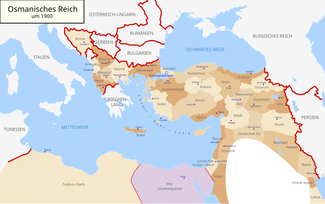
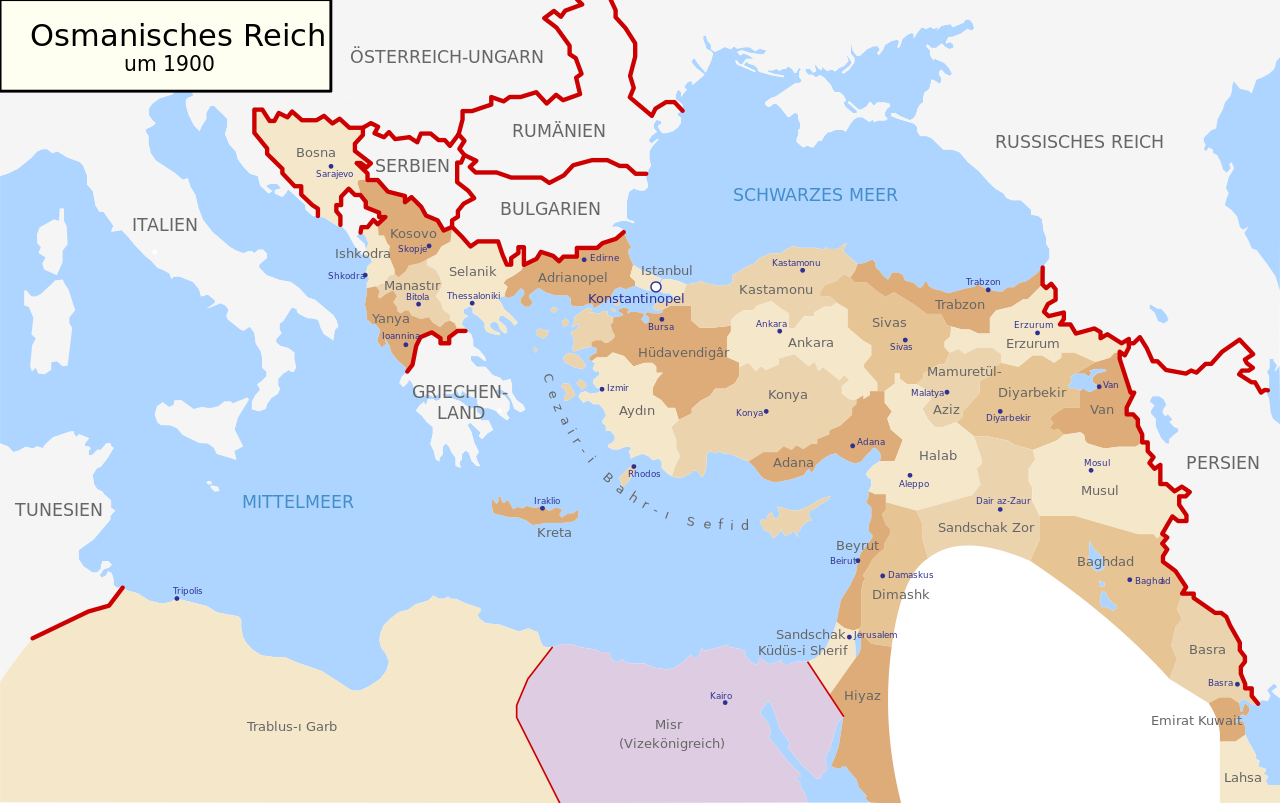
Map-of-Ottoman-Empire-in-1900-German.svg

Size of this PNG preview of this SVG file:
800 × 502 pixels
.
Other resolutions:
320 × 201 pixels
|
640 × 401 pixels
|
1,024 × 642 pixels
|
1,280 × 803 pixels
|
2,560 × 1,605 pixels
|
2,647 × 1,660 pixels
.
| Description |
Deutsch:
Karte des Osmanischen Reiches um 1900 in Deutsch
English:
Map of Ottoman Empire (1900) in German
|
| Date | (UTC) |
| Source | |
| Author |
|
| Other versions |
Map-of-Ottoman-Empire-in-1900-German.svg
[
]
Derivative works of this file: |


.svg)
.jpg)
I, the copyright holder of this work, hereby publish it under the following license:
|
|
I, the copyright holder of this work, release this work into the
public domain
. This applies worldwide.
In some countries this may not be legally possible; if so: I grant anyone the right to use this work for any purpose , without any conditions, unless such conditions are required by law. |
Original upload log
This image is a derivative work of the following images:
-
File:Map-of-Ottoman-Empire-in-1900-Latvian.svg
licensed with PD-self
- 2008-01-30T21:53:09Z Juristiltins 885x557 (105823 Bytes) {{Information |Description=Map of Ottoman Empire (1900) in Latvian |Source=own work |Date=30 January 2008 |Author=Juris Tiltins |Permission=Free use and distribution permitted. |other_versions= }} [[Category:Maps of the Ottom
Uploaded with derivativeFX