Magadan_1978.jpg
Size of this preview:
501 × 599 pixels
.
Other resolutions:
201 × 240 pixels
|
401 × 480 pixels
|
652 × 780 pixels
.
Summary
| Description |
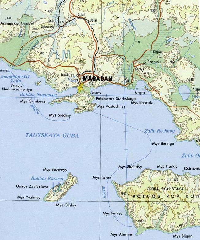
English:
Magadan area of far east Russia
|
| Date | |
| Source | Portion of Magadan sheet. Topographic Map NO 56, Series 1301. Original Scale 1:1,000,000. Printed by U.S. Defense Mapping Agency Topographic Center, 1978. From the PCL map collection, courtesy of the University of Texas Libraries, The University of Texas at Austin. [1] Transferred from en.wikipedia to Commons by Maksim . |
| Author | U.S. Defense Mapping Agency Topographic Center |
| Other versions |
.jpg)
|
|
This image is a work of a
U.S. military
or
Department of Defense
employee, taken or made as part of that person's official duties. As a
work
of the
U.S. federal government
, the image is in the
public domain
in the United States.
|

|