Maesbury_Castle_-_geograph.org.uk_-_179138.jpg
No higher resolution available.
Summary
| Description |
English:
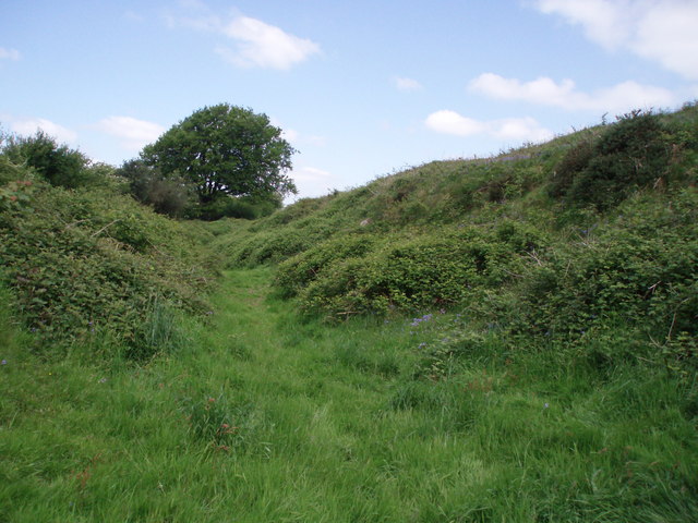
Maesbury Castle. This iron age hill fort lies on a 290m hill to the west of the village of Oakhill. The view here shows the ditch and rampart, now quite overgrown, on the southwest side of the hill fort.
|
| Date | |
| Source | From geograph.org.uk |
| Author | Sharon Loxton |
|
Attribution
( required by the license ) |
Sharon Loxton / Maesbury Castle / |
| Object location |
|
View this and other nearby images on: OpenStreetMap |
|
|---|
_heading:315.00&language=en)
Licensing

|
This image was taken from the
Geograph project
collection. See
this photograph's page
on the Geograph website for the photographer's contact details. The copyright on this image is owned by
Sharon Loxton
and is licensed for reuse under the
Creative Commons
Attribution-ShareAlike 2.0 license.
|
This file is licensed under the
Creative Commons
Attribution-Share Alike 2.0 Generic
license.
Attribution:
Sharon Loxton
-
You are free:
- to share – to copy, distribute and transmit the work
- to remix – to adapt the work
-
Under the following conditions:
- attribution – You must give appropriate credit, provide a link to the license, and indicate if changes were made. You may do so in any reasonable manner, but not in any way that suggests the licensor endorses you or your use.
- share alike – If you remix, transform, or build upon the material, you must distribute your contributions under the same or compatible license as the original.