MSH80_mailboxes_along_cowlitz_river_1980.jpg
Size of this preview:
800 × 522 pixels
.
Other resolutions:
320 × 209 pixels
|
640 × 418 pixels
|
1,024 × 668 pixels
|
1,280 × 835 pixels
|
2,919 × 1,905 pixels
.
Summary
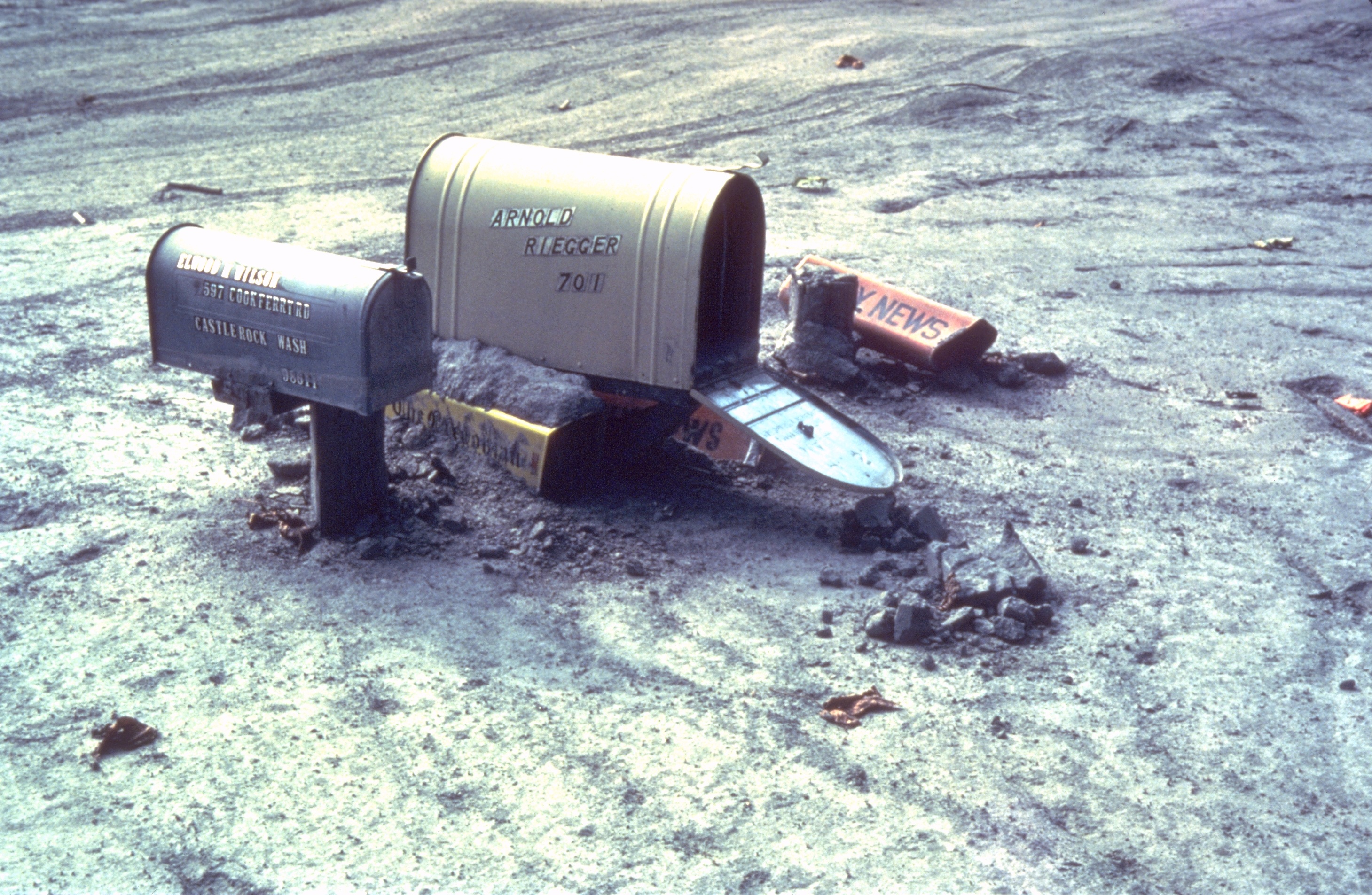
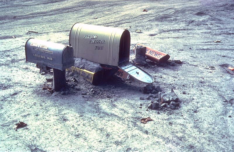
| Description | Mailboxes sticking out of a mudflow along the Cowlitz River in Castle Rock, Washington after the May 18, 1980 explosion of Mount St. Helens |
| Date | Summer 1980 |
| Source | Archived source link |
| Author | Lyn Topinka, USGS |
| Camera location |
|
View this and other nearby images on: OpenStreetMap |
|
|---|
Licensing
|
|
This image is in the
public domain
in the United States because it only contains materials that originally came from the
United States Geological Survey
, an agency of the
United States Department of the Interior
. For more information, see
the official USGS copyright policy
.
|
|