MN-Terr-1849-1851.jpg

Size of this preview:
773 × 600 pixels
.
Other resolutions:
310 × 240 pixels
|
619 × 480 pixels
|
990 × 768 pixels
|
1,280 × 993 pixels
|
2,560 × 1,986 pixels
|
3,126 × 2,425 pixels
.
Summary
| Description |
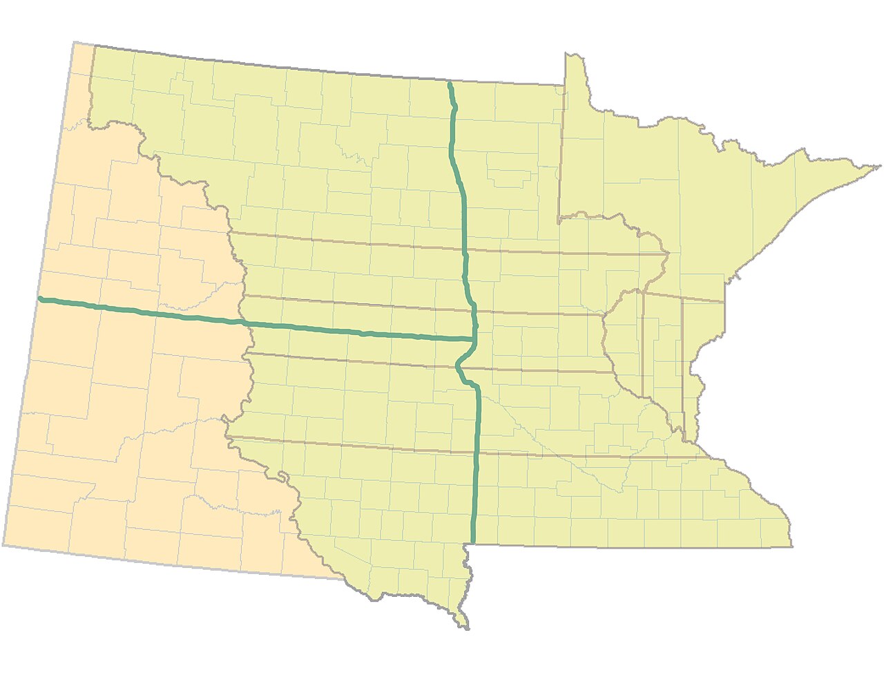
Map of the original nine counties of
English:
Minnesota Territory: 1849 to 1851
: the counties of Benton, Dakota, Itasca, Mankatah, Pembina, Ramsey, Wabashaw, Wahnahta, and Washington.
|
| Date | 26 February 2008 (original upload date) |
| Source |
Own work
(
CJLippert
)
|
| Author | CJLippert at en.wikipedia |
Licensing
|
|
This work has been released into the
public domain
by its author,
CJLippert
at
English Wikipedia
. This applies worldwide.
In some countries this may not be legally possible; if so: CJLippert grants anyone the right to use this work for any purpose , without any conditions, unless such conditions are required by law. |
Original upload log
The original description page was
here
. All following user names refer to en.wikipedia.
- 2008-02-26 00:59 CJLippert 3300×2550× (875063 bytes) {{Information |Description=Minnesota Territory: 1849 to 1851 |Source=self-made |Date= |Location= |Author=~~~ |other_versions= }}