Long_Beach_Street_Circuit_IndyCar.svg

Size of this PNG preview of this SVG file:
800 × 568 pixels
.
Other resolutions:
320 × 227 pixels
|
640 × 454 pixels
|
1,024 × 726 pixels
|
1,280 × 908 pixels
|
2,560 × 1,816 pixels
|
1,397 × 991 pixels
.
Summary
| Description |
English:
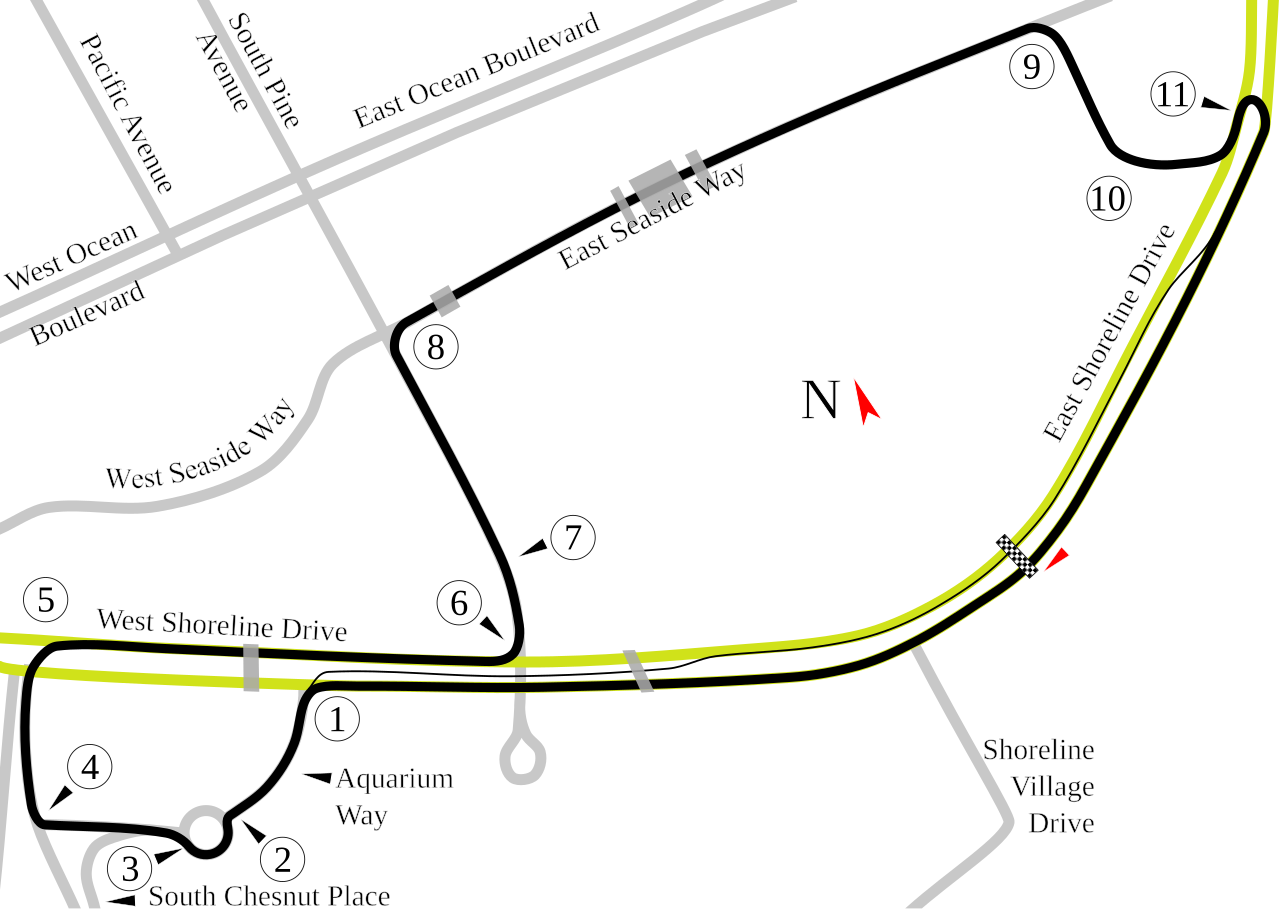
Track map of the
Long Beach Street Racing Circuit
. The yellow and gray lines are the local streets for reference. The gray transparent blocks over the streets and course are overpasses that interfere with the transmissions from the race cars.
|
| Source | Own work |
| Author | Will Pittenger |
| Camera location |
|
View this and other nearby images on: OpenStreetMap |
|
|---|
Licensing
|
|
I, the copyright holder of this work, release this work into the
public domain
. This applies worldwide.
In some countries this may not be legally possible; if so: I grant anyone the right to use this work for any purpose , without any conditions, unless such conditions are required by law. |