Llangurig_station_site_-_geograph.org.uk_-_747476.jpg
No higher resolution available.
Summary
| Description |
English:
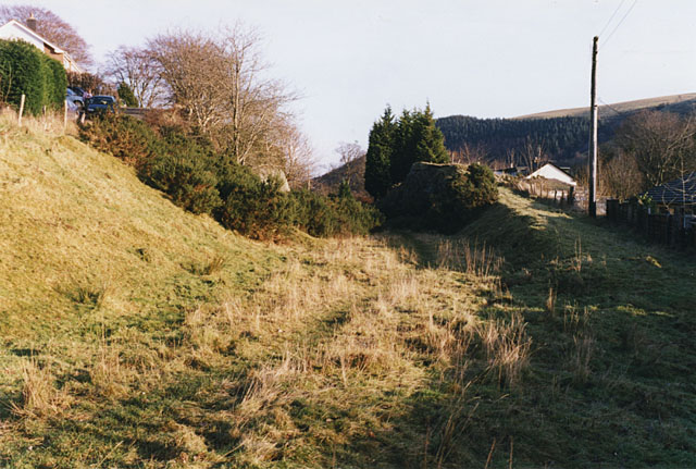
Llangurig station site The northern part of the Manchester & Milford Railway was built from near Llanidloes to this point, passing through the cutting seen ahead, and continuing about half a mile further. When the railway gave up its plans to cross the Cambrian Mountains, it was left to rot and eventually dismantled. In 1925 the GWR which had by then acquired the M&MR looked into reinstating the line as a branch, only to find that it itself had disposed of the land some years earlier.
|
| Date | |
| Source | From geograph.org.uk |
| Author | Nigel Brown |
|
Attribution
( required by the license ) |
Nigel Brown / Llangurig station site / |
| Camera location |
|
View this and other nearby images on: OpenStreetMap |
|
|---|
_heading:112.00&language=en)
| Object location |
|
View this and other nearby images on: OpenStreetMap |
|
|---|
_heading:112.00&language=en)
Licensing

|
This image was taken from the
Geograph project
collection. See
this photograph's page
on the Geograph website for the photographer's contact details. The copyright on this image is owned by
Nigel Brown
and is licensed for reuse under the
Creative Commons
Attribution-ShareAlike 2.0 license.
|
This file is licensed under the
Creative Commons
Attribution-Share Alike 2.0 Generic
license.
Attribution:
Nigel Brown
-
You are free:
- to share – to copy, distribute and transmit the work
- to remix – to adapt the work
-
Under the following conditions:
- attribution – You must give appropriate credit, provide a link to the license, and indicate if changes were made. You may do so in any reasonable manner, but not in any way that suggests the licensor endorses you or your use.
- share alike – If you remix, transform, or build upon the material, you must distribute your contributions under the same or compatible license as the original.