Levant_01.PNG
Size of this preview:
505 × 599 pixels
.
Other resolutions:
202 × 240 pixels
|
404 × 480 pixels
|
707 × 839 pixels
.

|
File:Kingdoms of Israel and Judah map 830.svg
is a vector version of this file. It should be used in place of this PNG file.
File:Levant 01.PNG →
File:Kingdoms of Israel and Judah map 830.svg
For more information, see
Help:SVG
.
|

|

|
This map has been uploaded by
Electionworld
from en.wikipedia.org to enable the
|
Summary
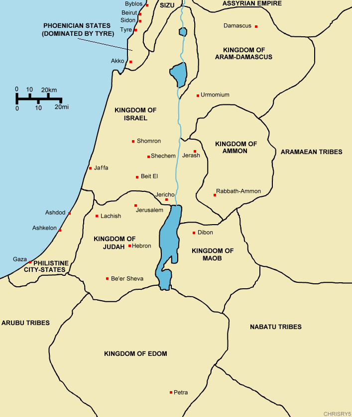
Created by ChrisRy5 using Macromedia Flash. City locations found on Wikipedia.
Map showing the ancient levant borders and ancient cities such as
Urmomium
and
Jerash
. The map also shows the region in the 9th century BCE. Notice the coastal land of Philistia, from which the name "
Palestine
" derives.
Correction: The kingdom to the east of the Dead Sea should be labeled the Kingdom of Moab.
Licensing
|
|
This work has been released into the
public domain
by its author,
ChrisRy5
. This applies worldwide.
In some countries this may not be legally possible; if so:
|