LeedsRingRdMoortown.jpg

Size of this preview:
800 × 468 pixels
.
Other resolutions:
320 × 187 pixels
|
640 × 374 pixels
|
1,024 × 599 pixels
|
1,280 × 749 pixels
|
2,945 × 1,723 pixels
.
Summary
| Description |
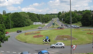
English:
Leeds Ring Road, A6120,looking East from King Lane roundabout, Moor Allerton towards the Harrogate Road junction
|
| Date | |
| Source | Own work |
| Author | Chemical Engineer |
| Camera location |
|
View this and other nearby images on: OpenStreetMap |
|
|---|
Licensing
|
|
I, the copyright holder of this work, release this work into the
public domain
. This applies worldwide.
In some countries this may not be legally possible; if so: I grant anyone the right to use this work for any purpose , without any conditions, unless such conditions are required by law. |