Latinalphabet_Former_Yugoslavia_2008.png

Size of this preview:
800 × 505 pixels
.
Other resolutions:
320 × 202 pixels
|
640 × 404 pixels
|
1,024 × 647 pixels
|
1,280 × 809 pixels
|
1,887 × 1,192 pixels
.

|
This
linguistic map
image could be re-created
using
vector graphics
as an
SVG
file
. This has several advantages; see
Commons:Media for cleanup
for more information. If an SVG form of this image is available, please upload it and afterwards replace this template with
{{

vector version available

|

new image name

}}
.
It is recommended to name the SVG file “Latinalphabet Former Yugoslavia 2008.svg”—then the template Vector version available (or Vva ) does not need the new image name parameter. |
Summary
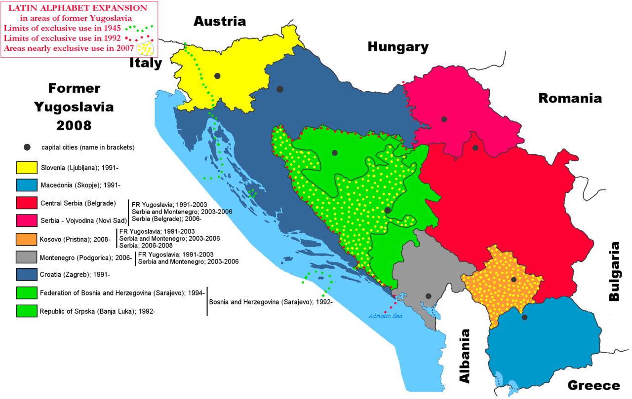
| Description | Map showing the expansion of the use of Latin alphabet in areas of former Yugoslavia. Green points until 1945 (former Italian areas); red points until the dissolution of Yugoslavia in 1992 (Slovenia and Croatia); "yellow points areas" with nearly exclusive use, but officially still allowing the Cyrillic alphabet (Croat-moslem Bosnia/Herzegovina and Kosovo). Basic map taken from Wikipedia commons (with free use). All the other areas of former Yugoslavia use both the Latin (but with minoritary use) and the Cyrillic alphabet. |
| Date | |
| Source | Own work |
| Author | Spalatino |
Licensing
|
|
I, the copyright holder of this work, release this work into the
public domain
. This applies worldwide.
In some countries this may not be legally possible; if so: I grant anyone the right to use this work for any purpose , without any conditions, unless such conditions are required by law. |