Lake_Pontchartrain_Causeway_south.jpg
Size of this preview:
800 × 534 pixels
.
Other resolutions:
320 × 214 pixels
|
640 × 427 pixels
|
1,024 × 683 pixels
|
1,500 × 1,001 pixels
.
| Description |
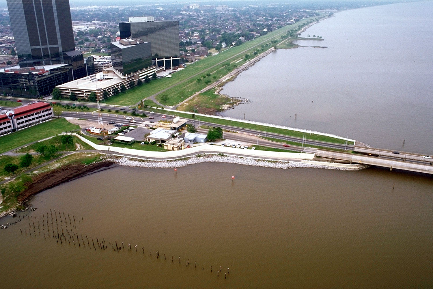
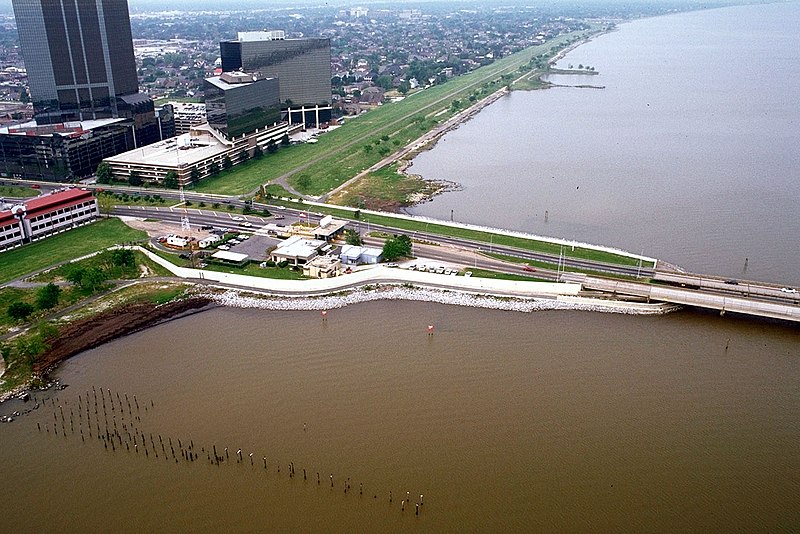
English:
The southern end of the Lake Pontchartrain Causeway at Metairie, Louisiana, USA. View is to the southwest near Causeway Boulevard, Metairie.
|
|||
| Date | ||||
| Source |
U.S. Army Corps of Engineers Digital Visual Library
Image page Image description page Digital Visual Library home page |
|||
| Author | Arthur Belala, U.S. Army Corps of Engineers | |||
|
Permission
( Reusing this file ) |
|
|||
| Location | New Orleans, Louisiana, USA |
| Camera location |
|
View this and other nearby images on: OpenStreetMap |
|
|---|