Ladakh-Garhwal-1863.jpg
Size of this preview:
800 × 581 pixels
.
Other resolutions:
320 × 232 pixels
|
640 × 465 pixels
|
1,024 × 744 pixels
|
1,280 × 930 pixels
|
2,340 × 1,700 pixels
.
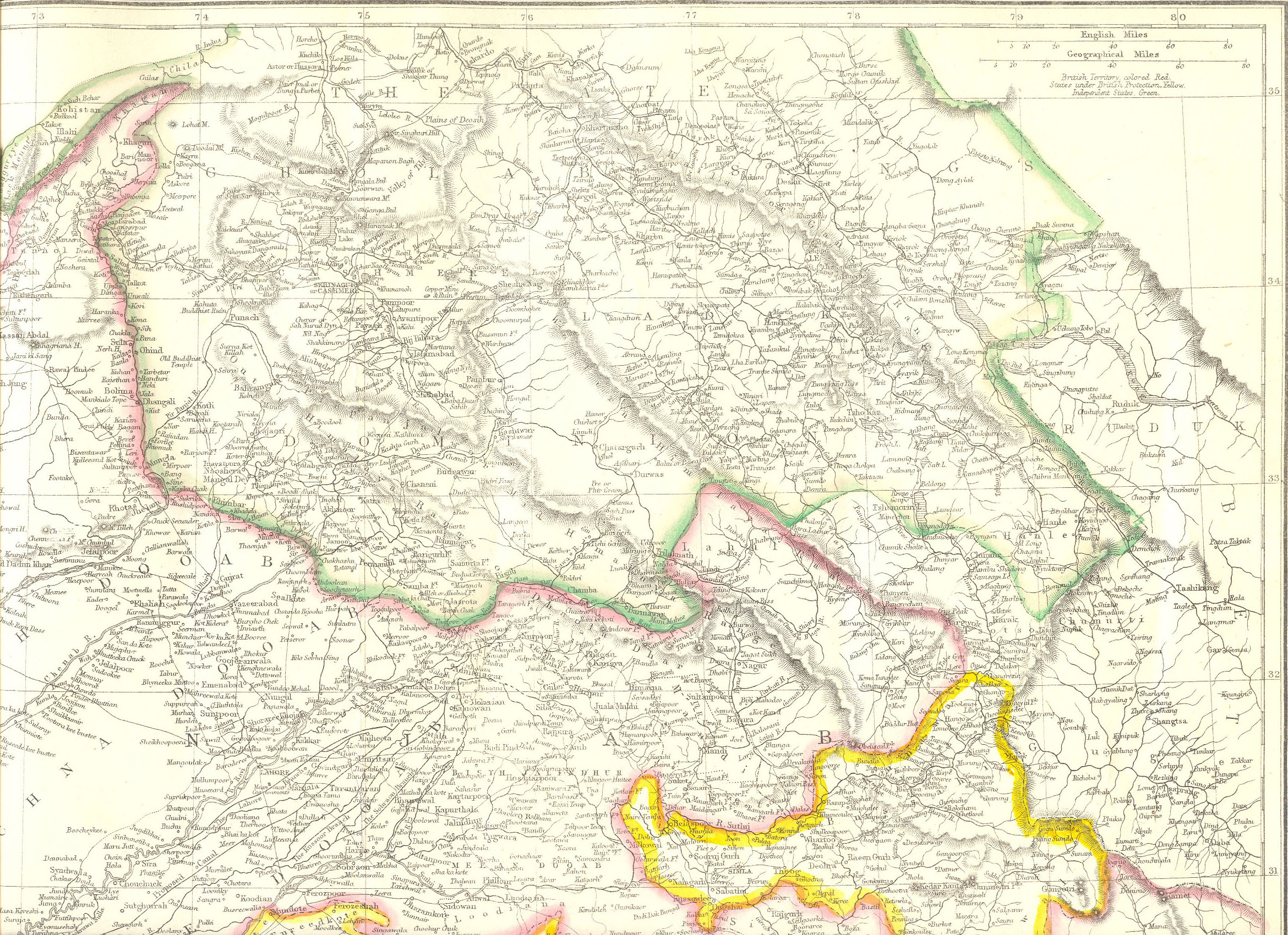
Summary
| Description |
English:
Map created by Edward Weller for
Weekly Dispatch
. South of Changchenmo valley, the borders were those documented by the Kashmir Boundary Commission headed by
Alexander Cunningham
. They may be compared with the hand-drawn maps made by
Henry Strachey
, the junior commissioner that actually surveyed the area.
|
| Date | |
| Source | http://www.columbia.edu/itc/mealac/pritchett/00maplinks/colonial/wellermaps/punjab1863/punjab1863.html |
| Author | Edward Weller (1819-1884) |
| Other versions |
Henry Strachey's map:

|
Licensing
|
|
This work is in the public domain in its country of origin and other countries and areas where the copyright term is the author's life plus 70 years or fewer . This work is in the public domain in the United States because it was published (or registered with the U.S. Copyright Office ) before January 1, 1929. |
| This file has been identified as being free of known restrictions under copyright law, including all related and neighboring rights. | |