LA2-Bergslagen-vatten.png

Size of this preview:
527 × 599 pixels
.
Other resolutions:
211 × 240 pixels
|
422 × 480 pixels
|
938 × 1,066 pixels
.

|
This
map
image could be re-created
using
vector graphics
as an
SVG
file
. This has several advantages; see
Commons:Media for cleanup
for more information. If an SVG form of this image is available, please upload it and afterwards replace this template with
{{

vector version available

|

new image name

}}
.
It is recommended to name the SVG file “LA2-Bergslagen-vatten.svg”—then the template Vector version available (or Vva ) does not need the new image name parameter. |
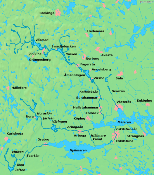
| Description | Map of lakes and rivers in south central Sweden , the Bergslagen region. Bounding box West 14.4°, South 59°, East 17.2°, North 60.6°. Center at 59°48′00″N 15°48′00″E / 59.80000°N 15.80000°E . | ||||
| Date | |||||
| Source | Background map from the Demis map server, rivers enhanced and names added by user:LA2 . | ||||
| Author | Background map from the Demis map server, rivers enhanced and names added by user:LA2 . | ||||
|
Permission
( Reusing this file ) |
|