Klawatti_Glacier_USGS.jpg

Size of this preview:
724 × 600 pixels
.
Other resolutions:
290 × 240 pixels
|
579 × 480 pixels
|
927 × 768 pixels
|
1,236 × 1,024 pixels
|
1,400 × 1,160 pixels
.
Summary
| Description |
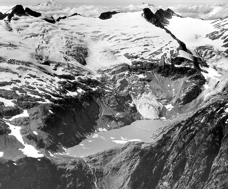
North Cascades National Park, Washington. Klawatti (center) and North Klawatti (right) Glaciers, north of Eldorado Peak. These glaciers have exhibited striking and diverse changes in recent years although they are closely adjacent. In 1947, stagnant ice from both glaciers covered the area of Klawatti Lake. At that time Klawatti Glacier ended on the steep cliff which it now descends in a spectacular icefall. Since 1947, the ice in the basin has melted. The lake, now 1 kilometer in length, has formed, and the Klawatti Glacier has advanced down the cliff. Meanwhile the lower part of North Klawatti Glacier has continued to thin. August 2, 1969. Plate 3-B, U.S. Geological Survey Professional paper 705-A. 1971. Image file: http://libraryphoto.cr.usgs.gov/htmllib/batch88/batch88j/batch88z/post0002.jpg |
|||||||||||||
| Date | ||||||||||||||
| Source | U.S. Geological Survey Photographic Library | |||||||||||||
| Author |
|
|||||||||||||
Licensing
|
|
This image is in the
public domain
in the United States because it only contains materials that originally came from the
United States Geological Survey
, an agency of the
United States Department of the Interior
. For more information, see
the official USGS copyright policy
.
|
|