Kingdom_of_kurdistan_1923.png

Size of this preview:
666 × 600 pixels
.
Other resolutions:
267 × 240 pixels
|
533 × 480 pixels
|
853 × 768 pixels
|
1,106 × 996 pixels
.

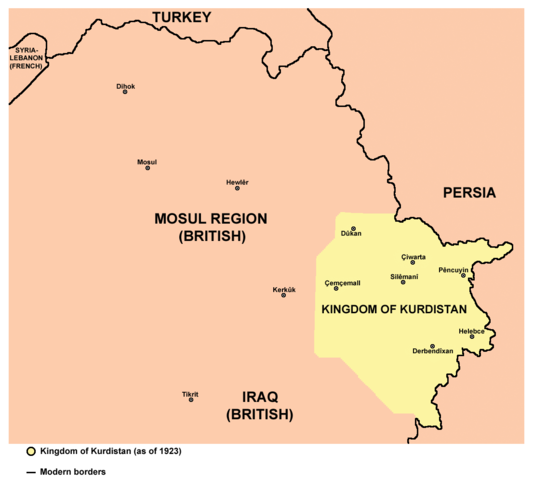
Summary
| Description |
English:
Map of the Kingdom of Kurdistan (as of 1923).
|
| Date | |
| Source | Own work |
| Author |
PANONIAN
Turkish version: User:Tavukluköy (Yeni Hesap) |
| Other versions | Turkish , Arabic |
Licensing
I, the copyright holder of this work, hereby publish it under the following license:
|
|
This file is made available under the Creative Commons CC0 1.0 Universal Public Domain Dedication . |
|
The person who associated a work with this deed has dedicated the work to the
public domain
by waiving all of their rights to the work worldwide under copyright law, including all related and neighboring rights, to the extent allowed by law. You can copy, modify, distribute and perform the work, even for commercial purposes, all without asking permission.
|
References
Borders of the Kingdom of Kurdistan are made in accordance with this source:
Name of the state:
Locations of main cities and towns:
- http://z5.ifrm.com/30192/69/0/p1104548/IraqKurdistan_2003_2005_lg.gif
- http://hdtravelpictures.com/wp-content/uploads/2011/03/221.gif