Kingdom_of_Hungary_counties.svg

Size of this PNG preview of this SVG file:
779 × 513 pixels
.
Other resolutions:
320 × 211 pixels
|
640 × 421 pixels
|
1,024 × 674 pixels
|
1,280 × 843 pixels
|
2,560 × 1,686 pixels
.
Summary
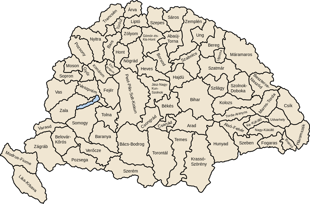
| Description | Map of counties of Kingdom of Hungary (Hungary proper and Croatia & Slavonia), 1886-1918 |
| Date | |
| Source | Own work |
| Author | User:IMeowbot |
| Other versions | Derivative works of this file: Kingdom of Hungary counties-2.svg |
| SVG development |
W3C-validity not checked.
|
Licensing
|
|
I, the copyright holder of this work, release this work into the
public domain
. This applies worldwide.
In some countries this may not be legally possible; if so: I grant anyone the right to use this work for any purpose , without any conditions, unless such conditions are required by law. |