Kianida_Island_or_Cianeis_Insula.png

Size of this preview:
800 × 536 pixels
.
Other resolutions:
320 × 214 pixels
|
640 × 429 pixels
|
951 × 637 pixels
.
Summary
| Description |
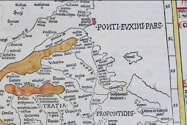
English:
A large island off the
en:Black Sea
coast of
en:Thrace
in the present Bulgaria-Turkey border area. Depicted on the 1467 map
Nona Europae Tabula
by
en:Nicolaus Germanus
based on
en:Claudius Ptolemy
's
Geography
.
[1]
|
| Date | |
| Source | https://archive.org/details/cosmographia00ptol/page/n195 |
| Author | en:Nicolaus Germanus |
Licensing
|
|
This work is in the public domain in its country of origin and other countries and areas where the copyright term is the author's life plus 70 years or fewer . This work is in the public domain in the United States because it was published (or registered with the U.S. Copyright Office ) before January 1, 1929. |
| This file has been identified as being free of known restrictions under copyright law, including all related and neighboring rights. | |
- ↑ Claudius Ptolemaeius (1482) Claudii Ptolomei Viri Alexandrini Cosmographie Octavus et Ultimus Liber Explicit Opus [1] , Ulm: Leinhart Holle