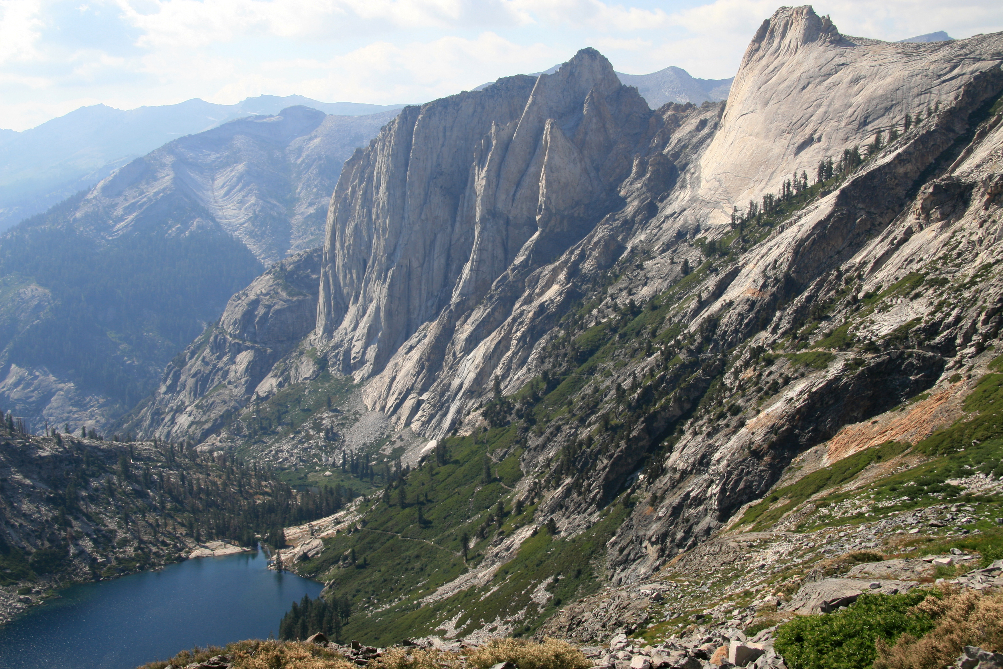
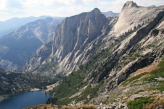
Kaweah_downValley.jpg
Size of this preview:
800 × 533 pixels
.
Other resolutions:
320 × 213 pixels
|
640 × 427 pixels
|
1,024 × 683 pixels
|
1,280 × 853 pixels
|
2,560 × 1,707 pixels
|
3,504 × 2,336 pixels
.
Summary
| Description |
English:
View looking down valley from the bowl under Kaweah Gap,
Sequoia National Park
,
California
. Shows Hamilton Lake, the Valhalla cliffs, and the High Sierra Trail switchbacking up.
|
| Date | |
| Source | Own work |
| Author | Jane S. Richardson ( talk · contribs ) |
| Camera location |
|
View this and other nearby images on: OpenStreetMap |
|
|---|
Licensing
I, the copyright holder of this work, hereby publish it under the following license:
This file is licensed under the
Creative Commons
Attribution 3.0 Unported
license.
-
You are free:
- to share – to copy, distribute and transmit the work
- to remix – to adapt the work
-
Under the following conditions:
- attribution – You must give appropriate credit, provide a link to the license, and indicate if changes were made. You may do so in any reasonable manner, but not in any way that suggests the licensor endorses you or your use.