Karte_Weltkulturerbe_Speicherstadt_und_Kontorhausviertel_mit_Chilehaus.png

Size of this preview:
800 × 551 pixels
.
Other resolutions:
320 × 220 pixels
|
640 × 441 pixels
|
1,024 × 705 pixels
|
1,280 × 882 pixels
|
2,560 × 1,763 pixels
|
6,493 × 4,472 pixels
.
Summary
| Description |
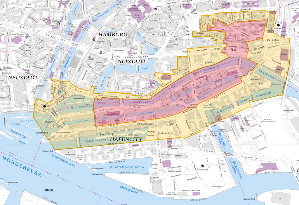
Deutsch:
Karte des UNESCO-Weltkulturerbes „Speicherstadt und Kontorhausviertel mit Chilehaus“ in Hamburg; rot: Welterbegebiet; orange: Pufferzone
English:
Map of the UNESCO World Heritage Site "Speicherstadt and Kontorhaus District with Chilehaus" in Hamburg; red: World Heritage Site; orange: buffer zone
|
| Date | |
| Source |
Own work using:
|
| Author | NordNordWest |

|
This map has been made or improved in the German
Kartenwerkstatt
(Map Lab)
. You can
propose maps
to improve as well.
|
Licensing

|
This file is licensed under the terms of the Data licence Germany – attribution – version 2.0 |
|
You are free:
Under the following conditions:
|