Jfader_dryden.jpg

Size of this preview:
800 × 593 pixels
.
Other resolutions:
320 × 237 pixels
|
640 × 474 pixels
|
1,024 × 758 pixels
|
1,280 × 948 pixels
.
|
Summary
| Description |
English:
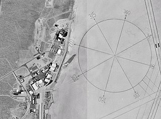
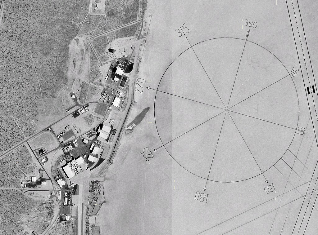
NASA 1m satellite photo (composite) of
Dryden Research Center
on Edwards Air Force Base, California.
|
| Date | 4 May 2005 (upload date) |
| Source | Screenshot from NASA World Wind software |
| Author | NASA |
| Other versions | File:Dryden AFB Compass Rose.jpg (version without yellow pixels) |
| Camera location |
|
View this and other nearby images on: OpenStreetMap |
|
|---|
Licensing
|
|
This image is in the
public domain
because it is a screenshot from
NASA
’s globe software
World Wind
using a public domain layer, such as Blue Marble, MODIS, Landsat, SRTM, USGS or GLOBE.
|

|