Israel_exports_bubble_map_2016.png
Size of this preview:
800 × 353 pixels
.
Other resolutions:
320 × 141 pixels
|
640 × 282 pixels
|
1,024 × 451 pixels
|
1,280 × 564 pixels
|
2,850 × 1,256 pixels
.
Summary
| Description |
English:
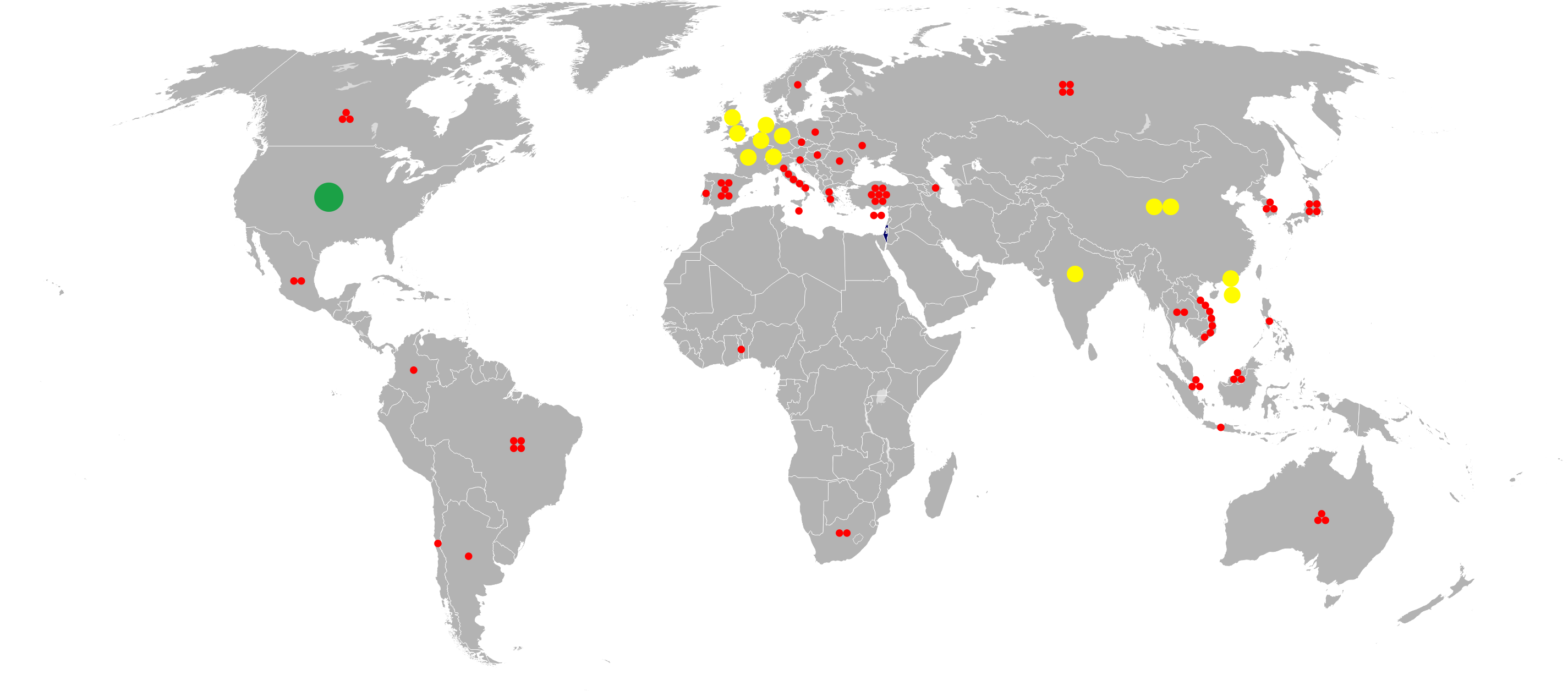
Bubble map of Israeli exports, based on 2016 data.
Source: https://atlas.media.mit.edu/en/visualize/tree_map/hs92/export/isr/show/all/2016/ Blank map used: File:BlankMap-World-v2.svg Map with older data: File:2006Israeli exports.PNG |
| Date | |
| Source | Own work |
| Author | Ynhockey |
| Other versions | File:Israel exports bubble map 2016.svg |
Licensing
I, the copyright holder of this work, hereby publish it under the following license:
This file is licensed under the
Creative Commons
Attribution-Share Alike 4.0 International
license.
-
You are free:
- to share – to copy, distribute and transmit the work
- to remix – to adapt the work
-
Under the following conditions:
- attribution – You must give appropriate credit, provide a link to the license, and indicate if changes were made. You may do so in any reasonable manner, but not in any way that suggests the licensor endorses you or your use.
- share alike – If you remix, transform, or build upon the material, you must distribute your contributions under the same or compatible license as the original.