Insel_Kalifornien_1650.jpg
Size of this preview:
800 × 574 pixels
.
Other resolutions:
320 × 229 pixels
|
640 × 459 pixels
|
1,024 × 734 pixels
|
1,280 × 918 pixels
|
1,813 × 1,300 pixels
.
Summary
| Description |
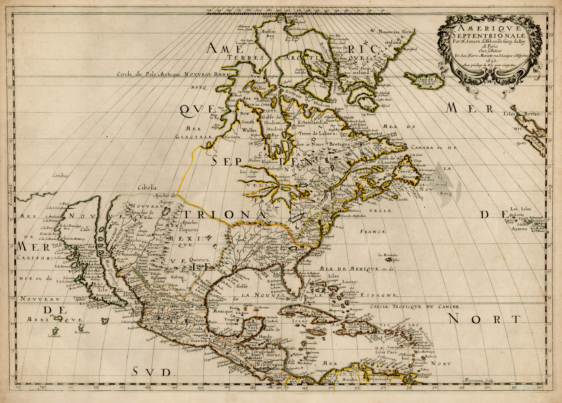
Deutsch:
Karte der
Insel Kalifornien
von
Nicolas Sanson
aus dem Jahr 1650. Kalifornien wurde damals für eine Insel, nicht für eine Halbinsel gehalten.
|
|||||||||
| Date | ||||||||||
| Source | Raremaps.com former image transferred from en.wikipedia | |||||||||
| Creator |
Nicolas Sanson (1600–1667)
|
|||||||||
|
Permission
( Reusing this file ) |
This image is in the public domain due to its age. The author died in 1667. | |||||||||
| Geotemporal data | ||||||||||
| Bounding box |
|
|||||||||
| Georeferencing | ||||||||||
Licensing
|
|
This work is in the public domain in its country of origin and other countries and areas where the copyright term is the author's life plus 100 years or fewer . |
| This file has been identified as being free of known restrictions under copyright law, including all related and neighboring rights. | |
Original upload log from en.wp
The original description page was
here
. All following user names refer to en.wikipedia.
- 2004-03-04 23:40 Decumanus 536×380× (62753 bytes) {{msg:PD-US}}
Original upload log from de.wp
The original description page was
here
. All following user names refer to de.wikipedia.
- 2008-04-27 18:41 Ahanta 536×380× (62753 bytes) {{Information |Beschreibung = The Island of California as shown on 1650 map by Nicolas Sanson. |Quelle = en:Island of California |Urheber = Nicolas Sanson. |Datum = |Genehmigung = {{ Bild-PD-alt}} |Andere Versionen = |Anmerkungen = }}