Inland_Niger_Delta_2007.jpg
Size of this preview:
691 × 599 pixels
.
Other resolutions:
277 × 240 pixels
|
554 × 480 pixels
|
886 × 768 pixels
|
1,024 × 888 pixels
.
Summary
| Description |
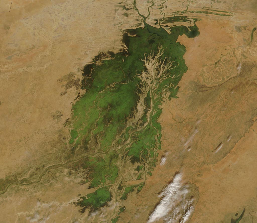
The MODIS on the Terra satellite took this picture of the Inland Niger Delta on November 11, 2007 shortly after the end of the rainy season when the landscape remained lush and green. This inland delta is a complex combination of river channels, lakes, swamps, and occasional areas of higher elevation. One such area of higher elevation is obvious in this image, and it forms a branching shape, like a tan tree pushing up toward the north. This wet oasis in the African Sahel provides habitat both for migrating birds and West African manatees. The fertile floodplains also provide much needed resources for the local people, who use the area for fishing, grazing livestock, and cultivating rice. |
| Date | |
| Source | http://modis.gsfc.nasa.gov/gallery/images/image11272007_250m.jpg |
| Author | Jeff Schmaltz, MODIS Land Rapid Response Team, NASA GSFC |
Licensing
|
|
This file is in the public domain in the United States because it was solely created by NASA . NASA copyright policy states that "NASA material is not protected by copyright unless noted ". (See Template:PD-USGov , NASA copyright policy page or JPL Image Use Policy .) |
|

|
Warnings:
|