Iditarod_Trail_BLM_map.jpg
No higher resolution available.
Summary
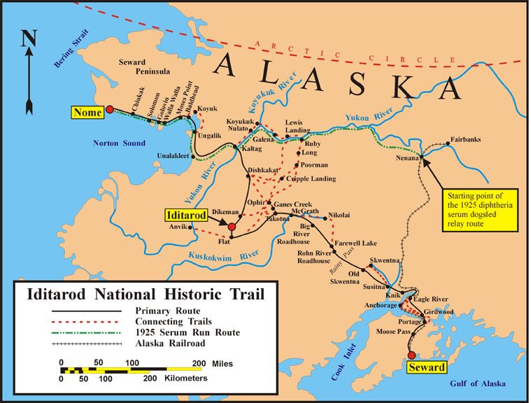
| Description | Map of the historical Iditarod Trail and the current Iditarod National Historic Trail in Alaska, USA |
| Date | |
| Source | U.S. Bureau of Land Management |
| Author | U.S. Bureau of Land Management |
|
Permission
( Reusing this file ) |
public domain, as a U.S. federal government work |

|
This
map
image could be re-created
using
vector graphics
as an
SVG
file
. This has several advantages; see
Commons:Media for cleanup
for more information. If an SVG form of this image is available, please upload it and afterwards replace this template with
{{

vector version available

|

new image name

}}
.
It is recommended to name the SVG file “Iditarod Trail BLM map.svg”—then the template Vector version available (or Vva ) does not need the new image name parameter. |


Licensing
|
|
This image is a work of a
Bureau of Land Management
* employee, taken or made as part of that person's official duties. As a
work
of the
U.S. federal government
, the image is in the
public domain
in the United States.
*or predecessor organization |
|