IL04_109.gif
No higher resolution available.
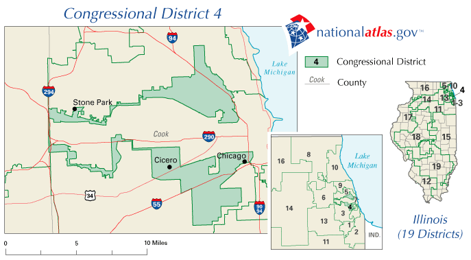
Summary
| Description |
English:
Illinois Congressional District 4
|
| Source |
from the U.S. National Atlas, Congressional District section Image size is 687x379 |
| Author | National Atlas of the United States |
Licensing
|
|
This map was obtained from an edition of the
National Atlas of the United States
. Like almost all works of the U.S. federal government, works from the
National Atlas
are in the
public domain
in the United States.
Online access: NationalAtlas.gov | 1970 print edition: Library of Congress , Perry-Castañeda Library
|
|
Original upload log
Transferred from en.wikipedia to Commons by Innotata using CommonsHelper .
The original description page was
here
. All following user names refer to en.wikipedia.
- 2005-06-23 05:25 TresÁrboles 687×379× (33055 bytes) Illinois Congressional District 4, from [http://nationalatlas.gov/congdistprint.html the U.S. National Atlas, Congressional District section] Image size is 687x379 {{PD-USGov}}