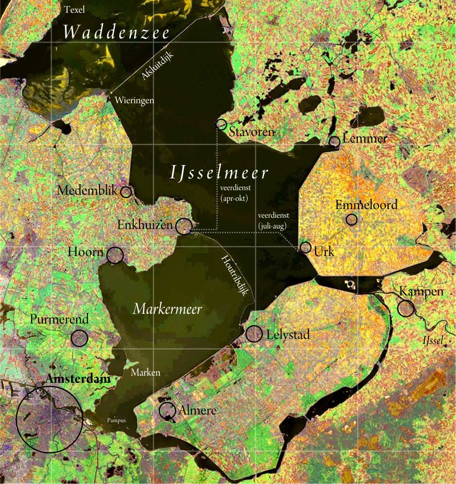
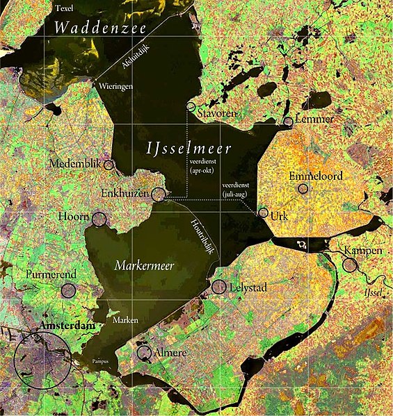
IJsselmeer_satellite.jpg
Size of this preview:
565 × 599 pixels
.
Other resolutions:
226 × 240 pixels
|
453 × 480 pixels
|
893 × 947 pixels
.
Summary
| Description |
Nederlands:
IJsselmeer
. Satellietopname:
Nasa Visible Earth
Samenstelling foto, kleur- en schaalcorrectie, kaartopmaak:
Ed Stevenhagen
English:
IJsselmeer
(also known as Lake IJssel or Lake Yssel) Satellite photo from Nasa Visible Earthvcomposition photograph, colours and scale correction, card layout done by Ed Stevenhagen
|
| Date | Commons upload by Siebrand 12:09, 23 May 2006 (UTC) |
| Source |
NASA Visible Earth. Originally on Wikipedia from nl.wikipedia ; description page is (was) here
|
| Author | User Ed Stevenhagen on nl.wikipedia |
|
Permission
( Reusing this file ) |
PD-NASA |
Licensing
|
|
This file is in the public domain in the United States because it was solely created by NASA . NASA copyright policy states that "NASA material is not protected by copyright unless noted ". (See Template:PD-USGov , NASA copyright policy page or JPL Image Use Policy .) |
|

|
Warnings:
|