Hurricane_Kenna_24_oct_2002_1750Z.jpg

Size of this preview:
461 × 599 pixels
.
Other resolutions:
184 × 240 pixels
|
369 × 480 pixels
|
591 × 768 pixels
|
788 × 1,024 pixels
|
1,575 × 2,048 pixels
|
8,000 × 10,400 pixels
.
| Warning | The original file is very high-resolution. It might not load properly or could cause your browser to freeze when opened at full size. |
|---|
Summary
| Description |
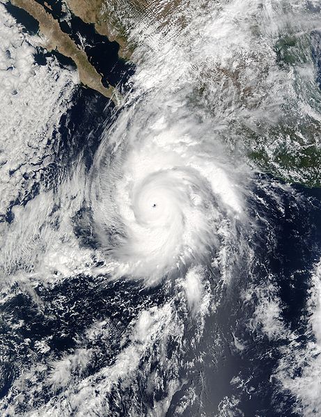
Packing winds of 160 miles per hour (257 km per hour), Hurricane Kenna intensified into a Category 5 storm on Oct. 25, 2002. Kenna is shown in this true-color image bearing down on Mexico’s west coast. This scene was acquired by the Moderate Resolution Imaging Spectroradiometer (MODIS), flying aboard NASA’s Terra satellite, on October 24. Category 5 hurricanes, the strongest category, are capable of causing catastrophic damage. The storm is predicted to make landfall by late morning on Oct. 25. |
|||||
| Date | ||||||
| Source | http://rapidfire.sci.gsfc.nasa.gov/gallery/?2002297-1024/Kenna.A2002297.1750.2km.jpg | |||||
| Author | Image courtesy of MODIS Rapid Response Project at NASA/GSFC | |||||
|
Permission
( Reusing this file ) |
|
|||||
| Other versions | Image:HurricaneKenna2002.jpg |
