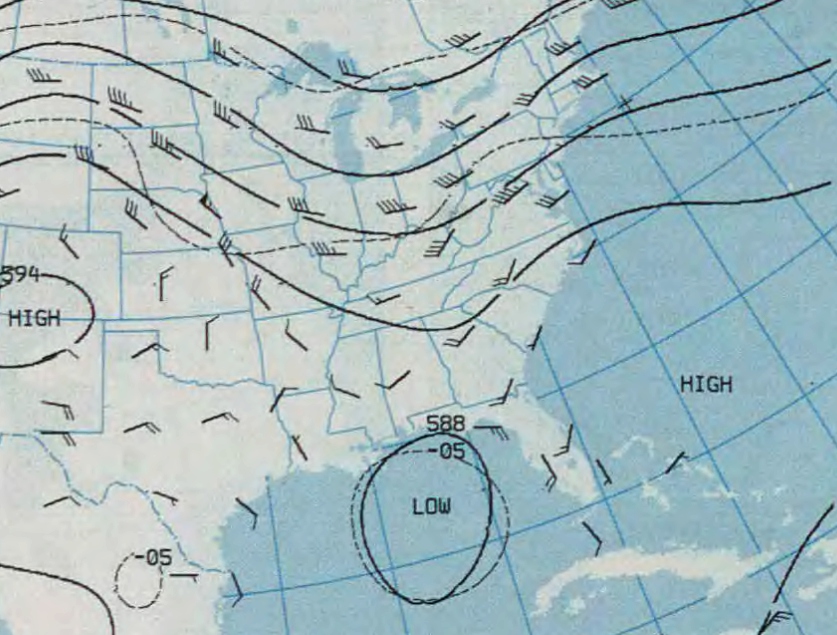
Hurricane_Elena_August_30_500_mb.jpg
Size of this preview:
790 × 599 pixels
.
Other resolutions:
317 × 240 pixels
|
633 × 480 pixels
|
837 × 635 pixels
.
| Description |
English:
500-mb geopotential height map of Hurricane Elena near the United States, on August 30, 1985.
|
|||
| Date | ||||
| Source | http://docs.lib.noaa.gov/rescue/dwm/1985/19850826-19850901.djvu | |||
| Author | NOAA Central Library Data Imaging Project | |||
|
Permission
( Reusing this file ) |
|